Leaders in Pipeline Survey Systems
OPERATOR’S MANUAL
Issue 4.04 - 1207 10
2.3. Getting Started
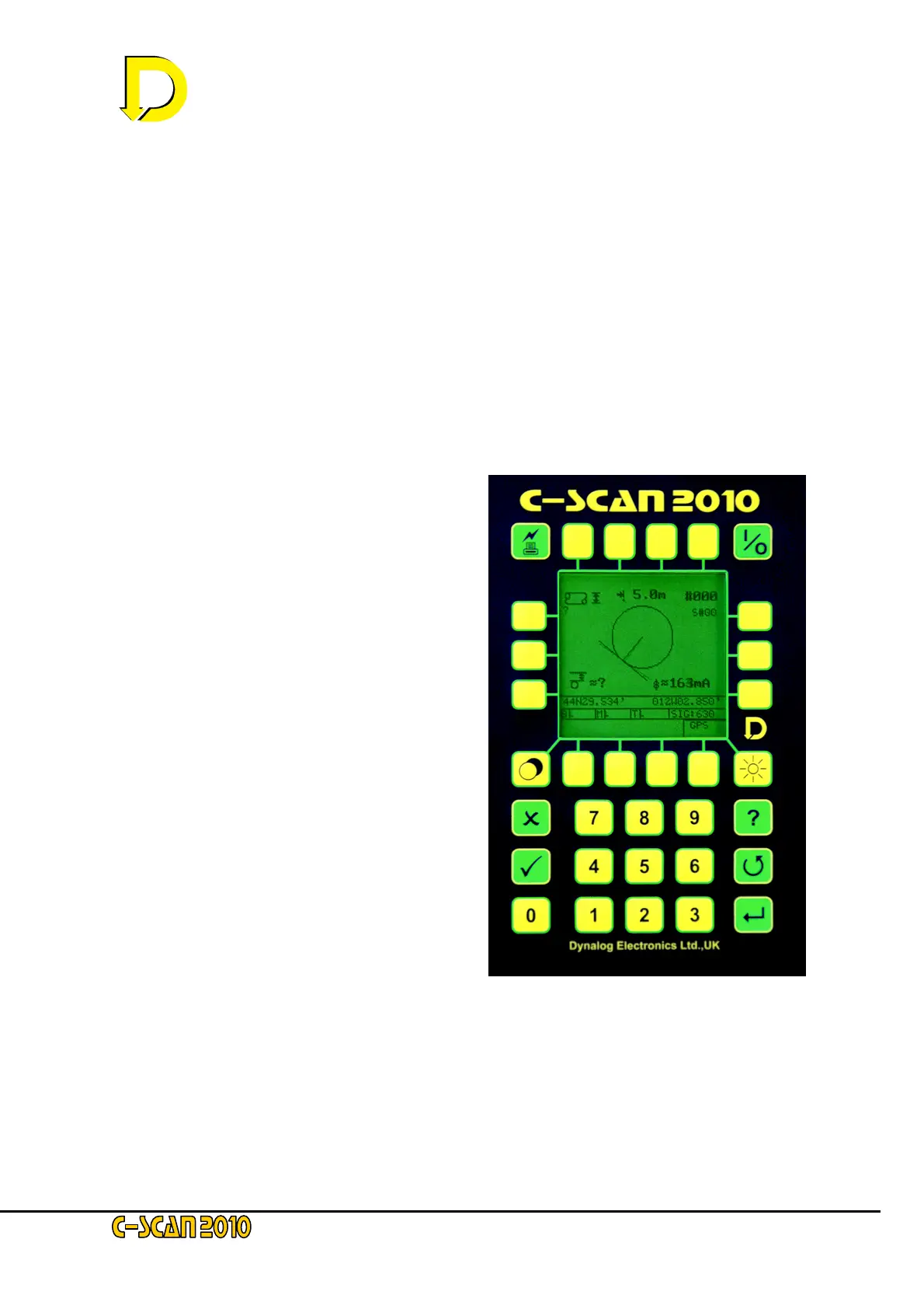
2.3.1 The display screen and keypad
The C-SCAN 2010 is the next generation design in the 2000 series Pipeline Survey System.
The system increases the speed and accuracy and includes more statistical features for
noise reduction, including:
• Built in Global Positioning System (GPS) unit for precision position indication.
• Attenuations can be calculated using GPS position information
• Full graphic interface allows the displaying of data without the use of a laptop or PC. The
Search facility displays:
• Pipeline position
• GPS position
• Approximate Depth/Cover
• Pipeline diameter
• Survey and location number
• Facility for recording pipeline
diameter and wall thickness.
• Display of approximate coating
conductance in µS/m
2
.
• Display of approximate coating
resistance in Wm
2
• Symbol inclusion for landscape
features
• Graphs include:
Attenuation – by chainage or
increment
Depth – cover or to centre line
Current – including close interval
plots
GPS position – show the plan of the
pipeline
• Full compatibility with DCAPP for Excel included in C-SCAN 2000
• Software upgradeable via PC
For more details of the display mode screen and the keypad layout see Figs. 6 and 7 below.

 Loading...
