Do you have a question about the Garmin CamperVan and is the answer not in the manual?
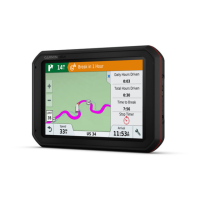
Instructions for physically installing and connecting the device to power.
Explains various driver alerts like speed limits, wrong-way driving, and how to enable/disable them.
Information on red light/speed camera alerts and database updates.
Step-by-step guide to finding specific street addresses.
Detailed guidance on finding and understanding parking information.
Locating nearby hospitals, police stations, and fuel stations.
Methods for saving locations for future access and organization.
Steps to save a found location for future access.
How to save your present position as a location.
Steps to begin navigation to a chosen destination.
Initiating navigation by selecting a point directly on the map.
Setting up and navigating to your home location.
Explains the various information elements shown on the map during navigation.
Information and prompts provided as you reach your destination.
Locating parking spots conveniently near your final destination.
Options for modifying and managing an active route.
Adding intermediate stops or destinations to an active route.
Modifying the route path by adding shaping points.
Settings for avoiding traffic, tolls, and other road restrictions.
Setting the device to automatically avoid traffic congestion.
Configuring the device to exclude toll roads from routes.
Defining and managing specific roads or areas to avoid.
Marking specific road segments to be avoided in route calculations.
Defining and avoiding geographical areas for routing.
Configuring the device for non-road navigation using a straight-line calculation.
Checking for traffic incidents and delays along the route.
Displaying real-time traffic conditions and delays on the map.
Options for personalizing map appearance and data layers.
Connecting the device to a smartphone via Bluetooth for enhanced features.
Managing Bluetooth features like calls and notifications for Android phones.
Managing Bluetooth features for iPhone connections.
Receiving and viewing smartphone notifications on the device.
How to view, ignore, or play notifications received from a smartphone.
Sending locations from the smartphone app to the device for navigation.
Making calls by manually entering a number.
Placing calls to contacts synced from the smartphone.
Using a connected smartphone to receive live traffic data.
Using a dedicated traffic receiver accessory for traffic data.
Activating the traffic feature on the device.
Displaying traffic flow and delays on the map interface.
Best practices for using voice commands for optimal recognition.
Initiating navigation and other functions using voice commands.
Placing calls using voice commands and contact names.
Checking current and future weather conditions.
Displaying animated weather radar maps.
Receiving and viewing weather-related alerts.
Viewing weather-related road conditions for your area or route.
Creating, saving, and editing multi-destination routes.
Functionality for retracing recent travel paths.
Viewing live traffic camera images for traffic conditions.
Setup and usage of connected wireless cameras.
Configuring route calculation, avoidances, and other navigation preferences.
Configuring driver alerts and safety features.
Options for clearing user data or restoring factory default settings.
Procedures for updating device maps and software.
Methods for updating maps and software using a Wi-Fi connection.
Using Garmin Express software on a computer to update the device.
Solutions for frequent device problems.
| Widescreen | - |
|---|---|
| Display diagonal | 6.95 \ |
| Touch technology | Multi-touch |
| Display resolution | 1024 x 600 pixels |
| Form factor | Handheld |
| Product color | Black |
| Marine (chartplotters, sounders) | No |
| Map coverage | Albania, Andorra, Croatia, Czech Republic, Denmark, Finland, France, Germany, Greece, Hungary, Iceland, Ireland, Italy, Lithuania, Netherlands, Norway, Poland, Portugal, San Marino, Slovakia, Spain, Sweden, Switzerland, Turkey, Ukraine, United Kingdom |
| Map view options | 2D/3D |
| Lifetime map updates | Roads change, but with Lifetime Map Updates your map will always be up to date. Start fresh every few months by downloading a new edition of the industry's most accurate map. New editions are issued four times per year. |
| Number of countries covered | 46 |
| Power source type | Battery |
| Battery life (max) | 1 h |
| Storage media type | Flash, Memory card |
| Compatible memory cards | MicroSD (TransFlash) |
| Internal storage capacity | 32 GB |
| Hands-free calling | Keep your hands on wheel with Bluetooth™ Hands-free calling. After pairing your compatible Bluetooth mobile phone to your TomTom GPS, you’ll be able to see incoming call information, make and answer calls, and talk hands-free through your device. You’ll e |
| Cables included | USB |
| Depth | 17.8 mm |
|---|---|
| Width | 172.7 mm |
| Height | 99 mm |
| Weight | 239.6 g |