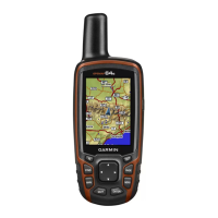
Do you have a question about the Garmin GPSMAP 64s and is the answer not in the manual?
| Outdoor (hiking, trekking) | Yes |
|---|---|
| Marine (chartplotters, sounders) | - |
| Routes quantity | 200 |
| Tracks quantity | 10000 |
| Number of waypoints | 5000 |
| Number of points of interest | 1000 |
| Traffic Message Channel (TMC) | No |
| Map coverage | World |
| Map view options | 2D/3D |
| Display diagonal | 2.6 \ |
| Display resolution | 160 x 240 pixels |
| Placement supported | Vertical |
| Display number of colors | 65536 colors |
| Storage media type | Flash |
| Compatible memory cards | MicroSD (TransFlash) |
| Internal storage capacity | 4 GB |
| Form factor | Handheld |
| Product color | Black, Red |
| International Protection (IP) code | IPX7 |
| Battery type | AA |
| Power source type | AC |
| Battery life (max) | 16 h |
| Battery technology | Lithium |
| Number of batteries supported | 2 |
| Cables included | USB |
| Depth | 36 mm |
|---|---|
| Width | 61 mm |
| Height | 160 mm |
| Weight | 260.1 g |
Process for the device to find and lock onto satellite signals.
Recording, saving, clearing, deleting, and viewing tracks.
Following saved routes and tracks, stopping navigation.
Accessing menus and understanding map features like orientation and measurement.
Using the compass, calibrating it, and managing altimeter settings.
Customizing trip data display and elevation plot options.
Downloading, navigating, and logging geocaches; using chirp accessories.
Tailoring displayed data and configuring core system parameters.
Activating power-saving modes and disabling GLONASS.
Modifying screen brightness and timeout for battery efficiency.
Guidance on connecting ANT+ accessories successfully.
Linking to a computer and copying files to the device.
Maintaining device condition and cleaning the exterior.
Resolving device unresponsiveness and restoring default settings.
Process for the device to find and lock onto satellite signals.
Creating, projecting, editing, and deleting waypoints.
Creating, editing, viewing, and deleting routes.
Following waypoints and modifying their information.
Creating, editing, viewing, deleting, and navigating routes.
Following active routes, stopping navigation, and reversing route direction.
Recording, configuring, and managing track logs.
Saving, clearing, deleting, and navigating saved tracks.
Locating addresses and navigating through the device's main pages.
Steps to ensure compass accuracy and navigate with it.
Customizing trip computer display and options.
Using Bluetooth for smartphone connectivity and pairing.
Creating, editing, and deleting custom device profiles.
