Garmin Pilot for iOS User’s Guide
190-01501-00 Rev. F
126
Fly
OverviewPlanFileFlySubscriptionsAppendicesIndex
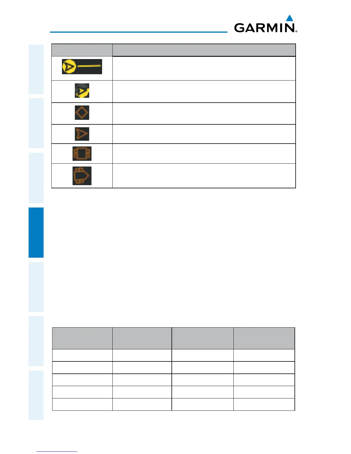
Symbol Description
Directional airborne Traffic Advisory (TA) with track vector. Points in the
direction of the aircraft track.
Directional off-scale airborne Traffic Advisory (TA). Points in the direction of
the aircraft track.
Ground traffic without directional information.
Directional surface traffic.
Non-directional non-aircraft ground traffic.
Directional non-aircraft ground traffic.
ADS-B Traffic Symbology
trAFFic Alerts (tA)
The GDL 39 automatically adjusts its Traffic Alert (TA) sensitivity level to reduce the
likelihood of nuisance TAs during various phases of flight. TAs are issued for traffic
when they are predicted to be within a specified volume of airspace around your
aircraft in a specified amount of time. The protected volume and time interval varies
based on the current geodetic altitude and groundspeed. Thus, the protected volume
of airspace increases with altitude and ground speed. Refer to the following table for
details.
A Traffic Alert popup is displayed when alerts are enabled, the aircraft is flying above
40 kts, and Garmin Pilot is not on the Traffic Page.
Altitude
(Geodetic)
Look Ahead Time
(sec.)
Vertical
Separation (ft.)
Horizontal
Separation (nm.)
Below 5,000 30 +/-850 .35
5,000-10,000 40 +/-850 .55
10,000-20,000 45 +/-850 .80
20,000-42,000 48 +/-850 1.10
Above 42,000 48 +/-1,200 1.10
Traffic Alerts
 Loading...