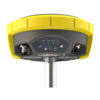
Points can also be staked out using the tilted pole.
Advantages:
•
No need to level the pole
•
Faster surveying procedures
•
Faster staking out of points
α
Tilt
This step-by-step procedure describes the tilt compensation implemented into the X‑PAD field
software,
☞
Zenith60 must be configured to receive RTK correction data and the sensor needs to
have reached a fixed solution.
1. Inside the selected job, go to the Survey tab and select Survey points.
2. To enable tilt compensated measurements go to Tools and select Survey setup.
3. In the GNSS tab, under Sensor mode select the Tilted pole (GNSS receiver)
option and press Accept.
4. The tilt initialisation icon appears in the bottom right corner of the screen, showing
that tilt functionality is activated.
Diagram
Tilt compensation,
step-by-step
26
Operation
 Loading...
