Do you have a question about the GeoMax Zoom90 and is the answer not in the manual?
Identifies the model and serial number of the product on the type plate.
Lists registered trademarks such as Windows and Bluetooth SIG.
Lists available documents like the Quick Guide and User Manual.
Explains directions to anticipate and avoid operational hazards.
Details intended use and reasonably foreseeable misuse of the product.
Specifies environmental limits and outlines duties of GeoMax and users.
Warns about dangers like electrocution, lightning, and unsecured sites.
Provides instructions on laser safety according to international standards.
Details the visible laser beam from the EDM module (Class 1).
Describes the visible laser beam classified as laser class 3R.
Explains the laser pointer classified as laser class 3R.
Details invisible laser beams for AiM (Class 1) and Prism Search (Class 1).
Explains the visible LED beam, excluded from laser safety standards.
Describes the visible red laser beam classified as laser class 2.
Explains EMC and the product's capability to function smoothly.
Provides FCC compliance information for digital devices.
Lists main components like Zoom90 instrument and data logger.
Defines terms and abbreviations found throughout the manual.
Details the instrument's software concept and language options.
Provides instructions for uploading firmware and software updates.
Details power options and battery usage for the instrument.
Explains storage options like SD card and internal memory.
Lists items included in the instrument's transport container.
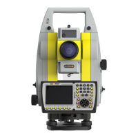
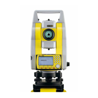
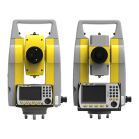
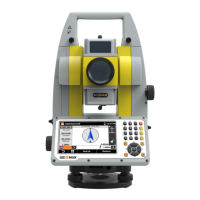
Illustrates and labels the main external components of the instrument.
Describes the instrument's keyboard layout and key functions.
Explains the functionality of common softkeys used by the system.
Details how to operate the interface via keyboard or touch screen.
Describes the main menu as the starting point for instrument functionality.
Explains how to access and view instrument and system information.
Provides a step-by-step guide for setting up the instrument.
Guides on setting up remote control using the RadioHandle accessory.
Details the process of installing USB drivers for PC connection.
Details instrument power on/off and power options menu.
Covers initial charging and general battery operating principles.
Illustrates the battery compartment and steps for changing the battery.
Explains how to insert and remove SD cards and USB sticks.
Guides on establishing a Bluetooth connection with external devices.
Explains the status indicated by LEDs on the RadioHandle.
Provides advice for achieving accurate distance measurements.
Allows setting units for angle, distance, temperature, and pressure.
Guides on configuring the instrument's date and time.
Covers setting up communication ports for data transfer.
Covers setting atmospheric parameters like temperature and pressure.
Explains how to load firmware, languages, and keys via SD card.
Introduces instrument calibration and types of adjustments.
Details prerequisites for instrument calibration.
Provides step-by-step instructions for calibration procedures.
Explains how to adjust circular levels on instrument, tribrach, and prism pole.
Details laser plummet inspection and tripod maintenance.
Explains how to format the system, deleting firmware and settings.
Covers safe practices for transporting the instrument and batteries.
Provides guidelines for storing the instrument and batteries.
Explains how to clean lenses, prisms, and the instrument.
Recommends periodic inspection of motorised instruments.
Lists angular accuracies and display resolutions.
Details ranges and accuracies for measuring with reflectors.
Lists ranges and accuracies for reflectorless measurements.
Specifies ranges and accuracies for long-range measurements.
Provides range and accuracy data for the AiM function.
Details range and search time for the Scout function.
Lists compliance with FCC, CE, and other regional regulations.
Details conformity, frequency band, output power, and antenna.
Warns about hazards associated with lithium batteries.
Summarizes optical, compensator, and level specifications.
Describes the display, keyboard, touch screen, and ports.
Details physical dimensions, weight, power, and internal battery.
Lists operating temps, protection ratings, humidity, and reflectors.
Lists automatic corrections and explains scale correction.
Details atmospheric correction parameters and their impact.
Provides charts and formulas for atmospheric and reduction corrections.
Mentions open source software and where to find licenses and source code.
Defines various axes of the instrument.
Explains the plumb line and the role of the compensator.
Defines the angle between plumb line and standing axis.
Defines sight errors and vertical circle reading deviations.
Presents the logical structure of the GeoMax Toolkit menu.
Shows the default directory structure for files on the USB memory stick.
Explains pin assignments and sockets for instrument ports.
| Type | Robotic Total Station |
|---|---|
| Protection class | IP55 |
| Magnification | 30x |
| Waterproof | Yes |
| Distance measurement accuracy (Reflectorless) | 2 mm + 2 ppm |
| Distance range (Reflectorless) | 1, 000 m |
| Operating temperature | -20°C to +50°C |
| Laser plummet accuracy | 1.5 mm at 1.5 m |
| Communication | Bluetooth, USB |
| Angle accuracy | 5" |
| Dimensions | 184 x 172 x 345 mm |

