PRIMUSr 1000 Integrated Avionics System
A28--1146--112--00
4-49
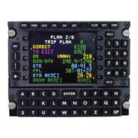
Electronic Flight Instrument System (EFIS)
D AltitudeAlertPreselect Display--Thisdata is displayedat thetop
of the altitude scale. The data is set by the guidance controller
altitudeselectknob.Thesetdatais cyan.When theaircraft iswithin
the altitude alert operating region, the box around theset data turns
from white to amber. The set data also turns amber. When a
departure from the selected altitude occurs, the select display box
also changes from white to amber.
The altitude alert operating region is defined as that time when the
aircraft enters the region where it is within 1000 feet of the
preselected altitudeduringacapturemaneuver.Atthistimethebox
around the set data turns to amber. Once the aircraft is within 250
feet of the preselected altitude, the box turns back to cyan. After
capture, the aircraft re--enters the altitude alert operating region if it
departsmorethan250feetfromtheselectedaltitude. A momentary
audio alert is sounded when the aircraft is 1000 feet from the
preselectedaltitudeorhasdeparted250feetfromtheselectaltitude
after capture.
D Altitude Digital Display -- A digital display of the actual altitude
valueiscontainedinthedisplaywindow.This dataisamagnification
of the digits on the scale and is readable to within a 20--foot
resolution. The digits within the pointer are green. Below 10,000
feet, boxed hash marks are used to show that the
ten--thousand--foot digit is missing.
D Barometric Altimeter Display -- The baro set display is located
directly below the altitude tape. The pilot can set the altimeter in
either inches of mercury (inHg) or hecto Pascals (hPa) as selected
with the PFD bezel controller. If the on--side DC is invalid, the SG
defaults to the last selection(In orhPa).Thebarosetdataisalways
cyan.
D Low Altitude Awareness Symbol -- At radio altitudes of 550 feet
or less, the lower part of the altitude tape linearly changes from a
gray raster to brown and the altimeter scalemarkings are removed.
At zero radio altitude, the brown raster touches the altimeter
reference line.
D AltitudeAnalogScale--Thealtitude tapeisamovingscaledisplay
with fixed pointer. The scale markings on the tape are labeled in
500--foot increments. The scale digits are arranged with the larger
numbers at the top. The scale and its markings are white. The
500--foot tick marks are enhanced below 10,000 feet.
 Loading...