150
Change the Chart Orientation and Motion Mode
C C O M M
The Chart View pans automatically so the boat is always centered on the view. The settings in this section allow you to change the
chart orientation, zoom the view automatically, set the north reference, and see more or less of the view based on the speed or
range setting.
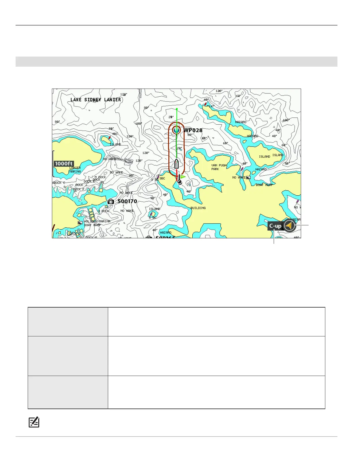
Set the Chart Orientation
Chart Orientation set to Course Up
north up
indicator
chart orientation
Set the Chart Orientation
1. Main Menu: Press the MENU key twice. Select the Chart tab.
2. Select Chart Orientation.
3. Select an orientation to apply to the chart.
North-Up
The chart is oriented with North up on the display, and the boat rotates according
to its heading or COG (Course Over Ground).
Head-Up
(compass or GPS required)
The boat’s current heading points up, and the chart rotates around the boat icon
so that it always points up on the view. The heading is provided by the connected
compass/heading sensor. If a compass is not connected, the boat will be oriented
according to COG (Course Over Ground).
Course-up
During navigation, the intended course or route leg is shown at the top of the view.
Objects ahead of the boat are drawn above the boat. When the boat is not navigating,
the current heading is displayed.
NOTE: The North Up Indicator will change as the orientation and data source change. To display the North Up Indicator, see
Customize the Chart View.
 Loading...