93
Side Imaging Sonar
U S I V
Side Imaging beams “illuminate” the bottom contour, structure, and fish. The side beam coverage is very thin from front to back,
yet very wide from top to bottom. The bottom composition determines the intensity of the sonar return, and upward slopes that
face the transducer reflect sonar better than downward slopes that face away from the transducer.
For Best Side Imaging Performance
• Boat Speed: trolling
• Straight line navigation
• Minimum turning time and wave turbulence
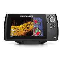
Side Imaging View (CHIRP MEGA SI)
(HELIX 9 CHIRP SI GPS G2N)
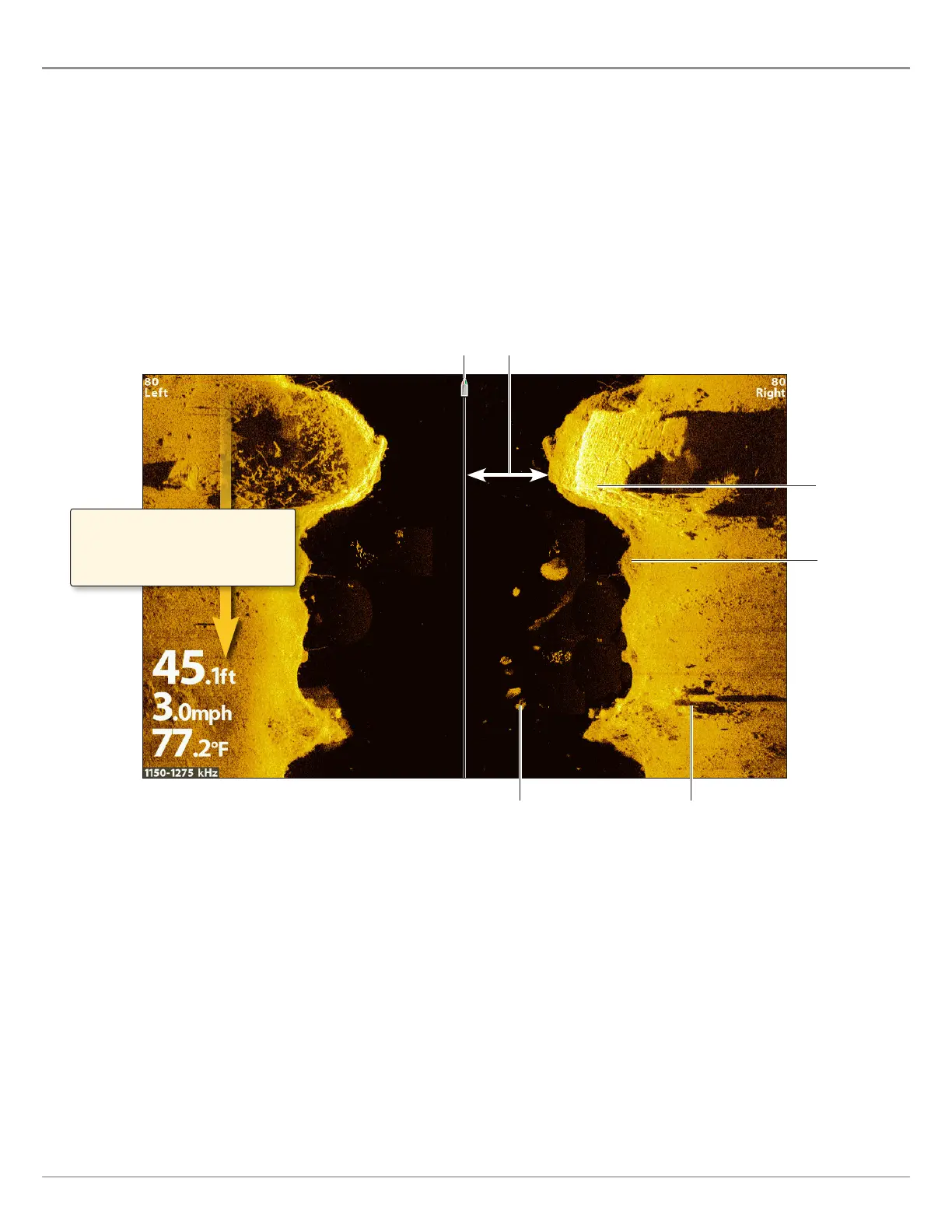
boat icon
shadowswhite streaks
water column
dark shades
light shades
Side Imaging sonar returns are first
displayed at the top of the screen, and
historical data scrolls down the display
as new information is received.
Use the light and dark parts of the display to interpret the objects on the view as follows:
Shadows: The longer the shadow, the taller the object. Fish also cast shadows, and their distance from the bottom can be
interpreted by their shadow.
Light Shades represent denser terrain (possibly compacted sediment, timber, rocks) or rising terrain.
Water Column: shows the relative depth of the water under the boat at any given time. Variations in the width of the water
column show variations in the distance to the bottom as the boat passes over. See the illustration Interpreting the Side
Imaging View.
White Streaks or Clouds may represent fish on the display.
Dark Shades represent soft returns (possibly sand or mud) or descending terrain.
 Loading...