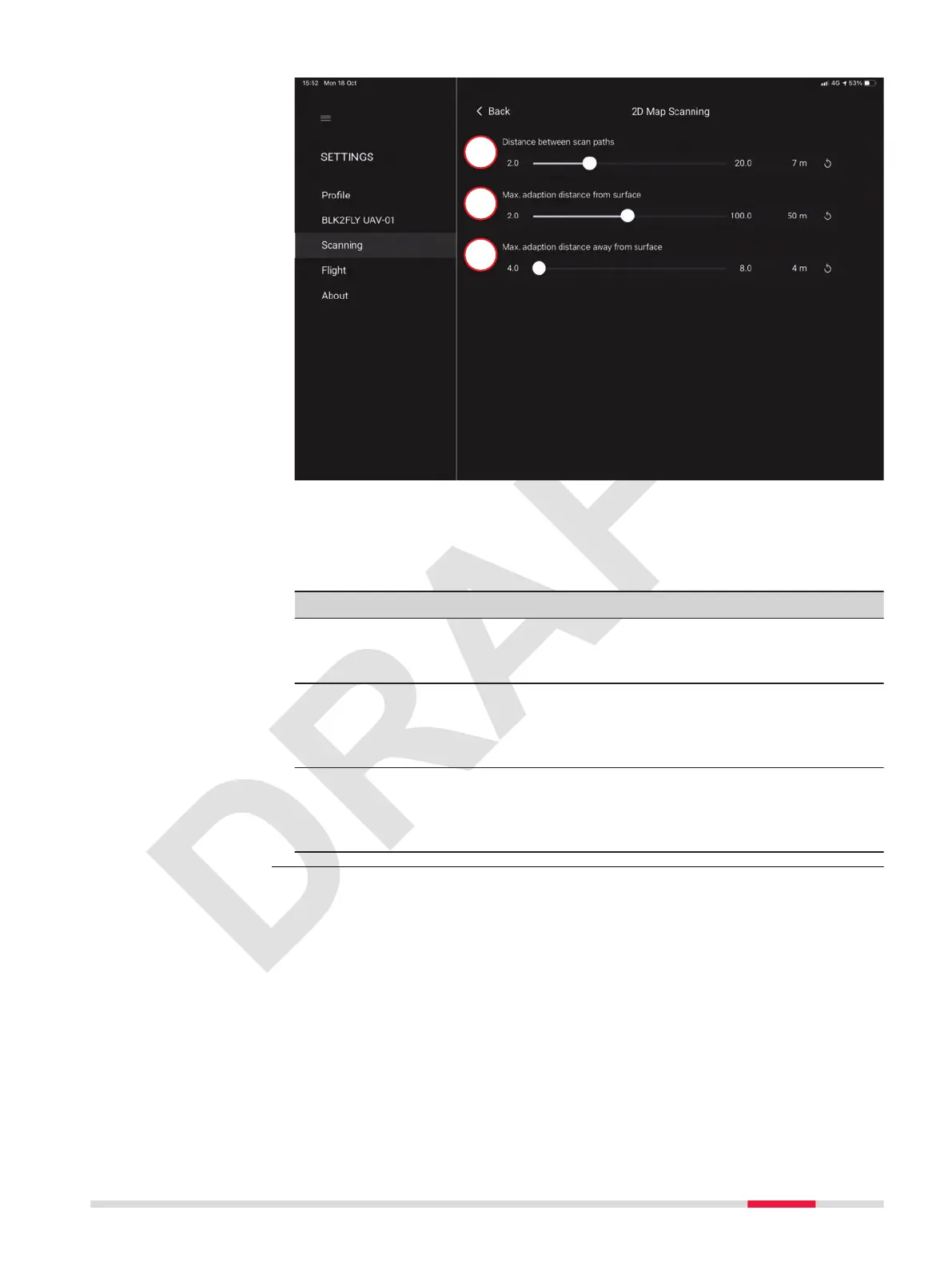
a Distance between scan paths
b
Max. adaption distance from sur-
face
c Max. adaption distance away
from surface
Detailed description
Type Description
Distance between
scan paths
Denes the distance between scan lines/ight
lines. The closer the scan lines are dened, the
more dense is the point cloud.
Max. adaption dis-
tance from surface
Maximum adaption distance denes on how much
the UAV is allowed to deviate from its original
planned path/plane towards the surface. For
example, if there is a large whole.
Max. adaption dis-
tance away from sur-
face
Maximum adaption distance denes on how much
the UAV is allowed to deviate from its original
planned path/plane away from the surface. For
example, if there is a high building.
2D Map Scanning
screen
Description of the Application, Mission Planning 67