12
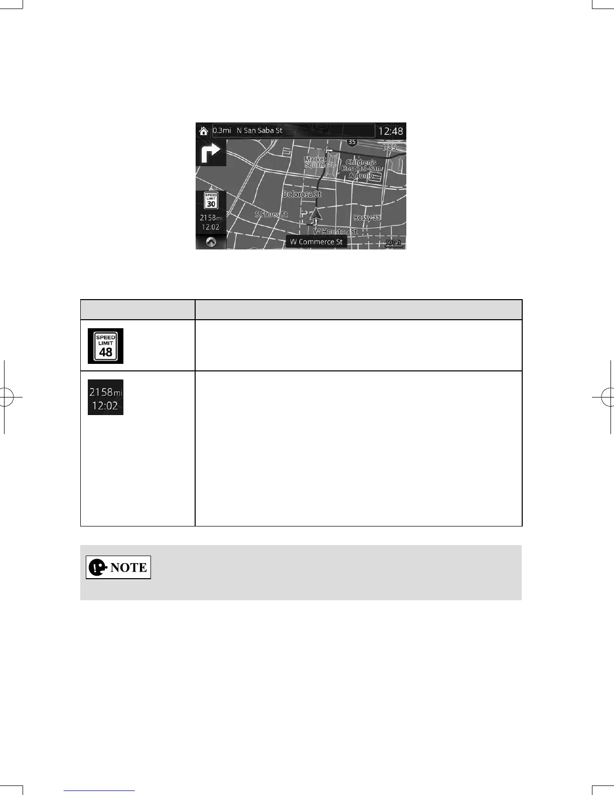
2.4 Mapscreen
2.4.1 Navigatingonthemap
The data elds are different when you are navigating an active route and when you
have no specied destination (the burgundy line is not displayed).
Field Description
Shows the speed limit of the current road if the map
contains it.
Shows the distance you need to travel on the route before
reaching your nal destination.
Shows the estimated arrival time at the nal destination of
the route.
If the navigation system is capable of receiving live trafc
information, the calculation takes into account trafc
delays affecting your route.
This estimation can be inaccurate at times.
Some functions are not available depending on some countries and regions.
NAV-12AVUAE.indb 12 2015/02/20 15:09:07