13
1
2
3
4
5
6
2.4.2 Positionmarkers
2.4.2.1 Selectedmaplocation(Cursor)andselectedmapobject
You can mark a map location in the following ways:
• Select the map during route guidance.
• Select the map when asked so that the destination can be conrmed after the
search is completed.
• Select the destination from the map. (page 54)
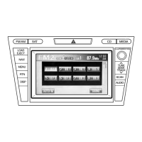
When a map location is selected, the Cursor appears at the selected point on the
map. A symbol
with a combined crosshair and red circle is displayed for easy
visibility of any map scale size.
The location of the Cursor can be used as the destination of the route.
You can search for a POI (point of interest), or you can save it as one of your
Favorites destinations.
You can also select some of the objects on the map. If you select the map at the icon
of a POI (point of interest) or a trafc event, the object will be selected. You can
then get information about this object or use it as a route point.
Some functions are not available depending on some countries and regions.
2.4.3 Objectsonthemap
2.4.3.1 Streetsandroads
The navigation system shows the roads in different widths and colors so that they
can be easily identied. A highway/freeway will be thicker and a different color than
a small street.
NAV-12AVUAE.indb 13 2015/02/20 15:09:07