19
1
2
3
4
5
6
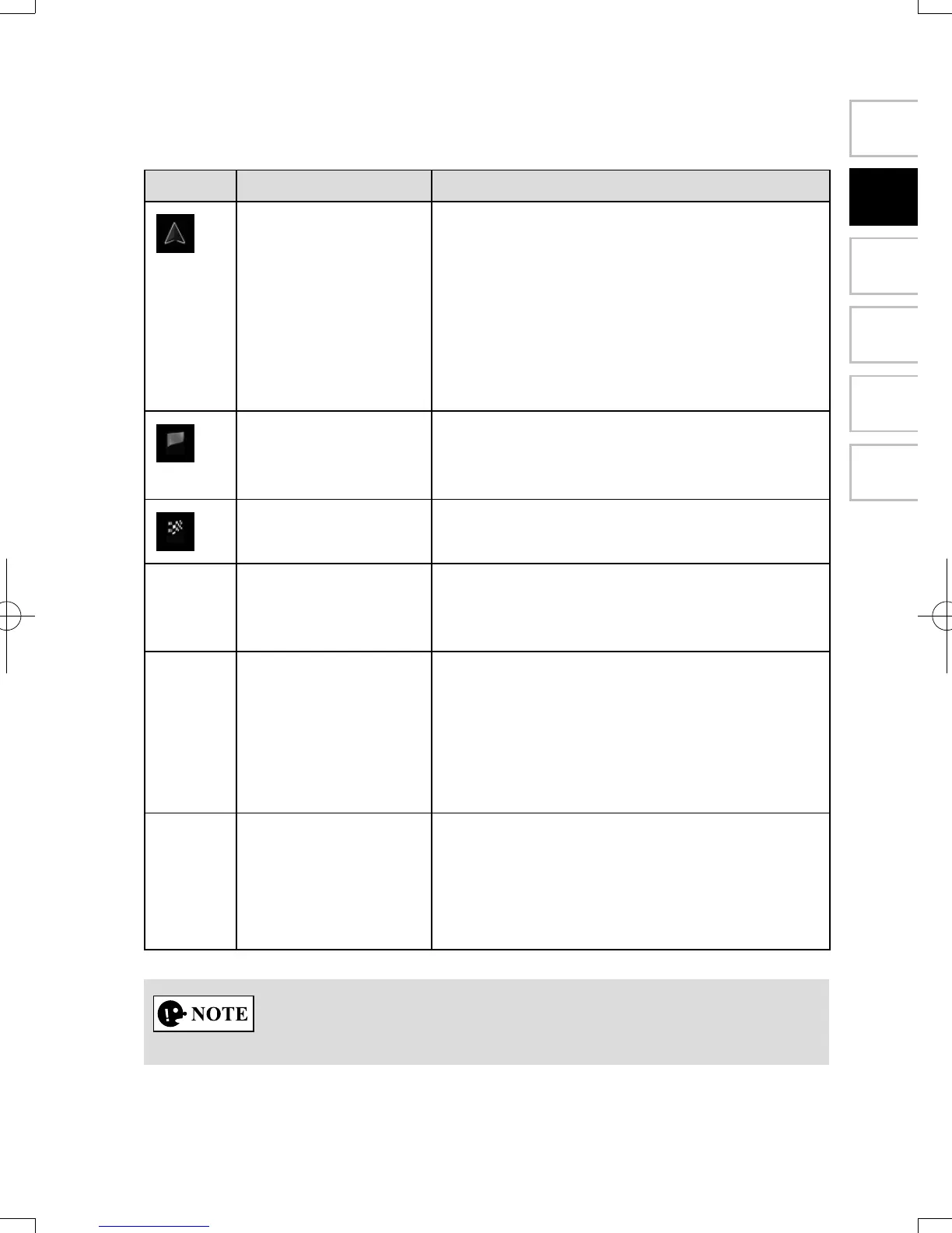
2.4.3.6 Elementsoftheactiveroute
The navigation system shows the route in the following way:
Symbol Name Description
Current car position
marker
If there is a road close by, a blue-colored
arrow symbol moves to the road which is the
closest.
The red mark present around a blue-colored
arrow symbol indicates the correct GPS
information. It may be indicated away from
the road because there is no existing road
information.
Waypoint
(intermediate
destination)
An intermediate destination of the route
before reaching the nal destination.
Destination (end
point)
The nal destination of the route.
Route color The route always stands out with its color on
the map, both in daytime and in nighttime
mode.
Streets and roads
that are excluded
from the navigation
You can choose whether you want to use or
avoid certain road types (page 80). However,
when the navigation system cannot avoid
such roads, the route will include them and
it will show them in a color that is different
from the route color.
Streets and roads
that are affected by
trafc events
Road segments may be affected by trafc
events received. These streets and roads are
displayed in an alternate color, and small
symbols displayed along the route show the
type of trafc event.
Some functions are not available depending on some countries and regions.
NAV-12AVUAE.indb 19 2015/02/20 15:09:07