Page 22/70 | May 2015 | 2.0
4.1.1. A+ field
When defining a field in this way, a reference line
is created based on a fixed point. A prerequisite
for defining a field in this way is that the direction
of the required reference line is already known.
After tapping A+ at the bottom of the screen, the
menu will display the option Create field: A+
(Figure 21).
Now set your vehicle in the correct position. The
front of the vehicle should be pointing towards the
end of the field. Tap on A at the bottom of the
screen in order to define the starting point of the
reference line. The A coordinate is now saved.
This can be derived from the numbers behind the
latitude, longitude and height.
Tip!
When defining the A point, the vehicle must
be stationary. This makes it easier to
precisely define where this point should be.
Point A is the position of the GPS antenna
on the tractor.
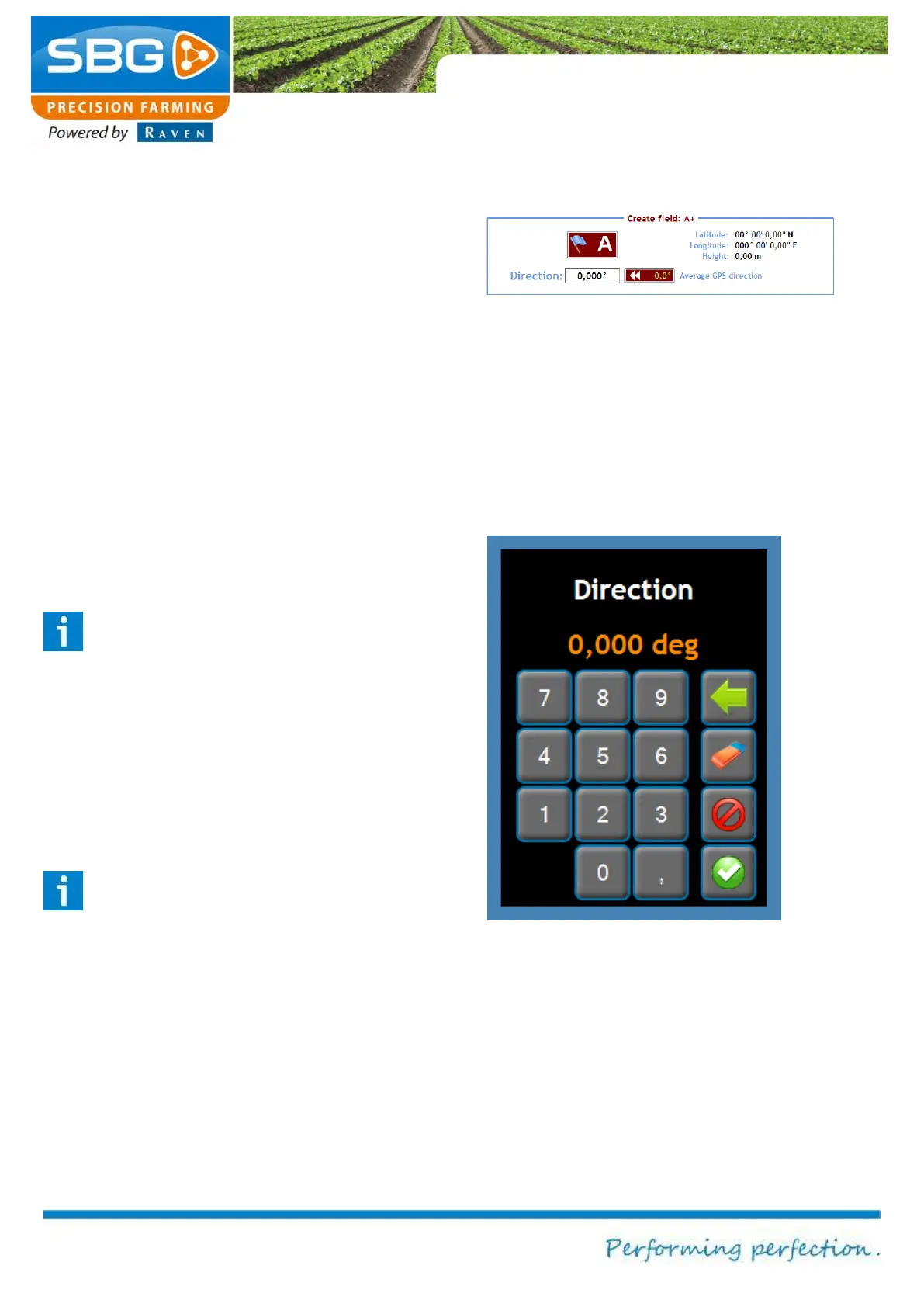
The numbers under A+ are used to define the
direction (Figure 22). This value can be set to a
value between 0.000 and 360.000 degrees.
Tip!
In order to ensure the highest degree of
accuracy, the direction must always be
given with three decimal places.
In addition to the manual entry of the direction,
you can also drive a few metres so that a value
will appear in Average GPS direction. The value
can now be entered automatically in Direction.
The defined field can now be saved by tapping on
READY at the top left of the screen. This
operation can be aborted by tapping on ABORT.
Figure 21 Creating a field: A+
Figure 22 Setting the direction