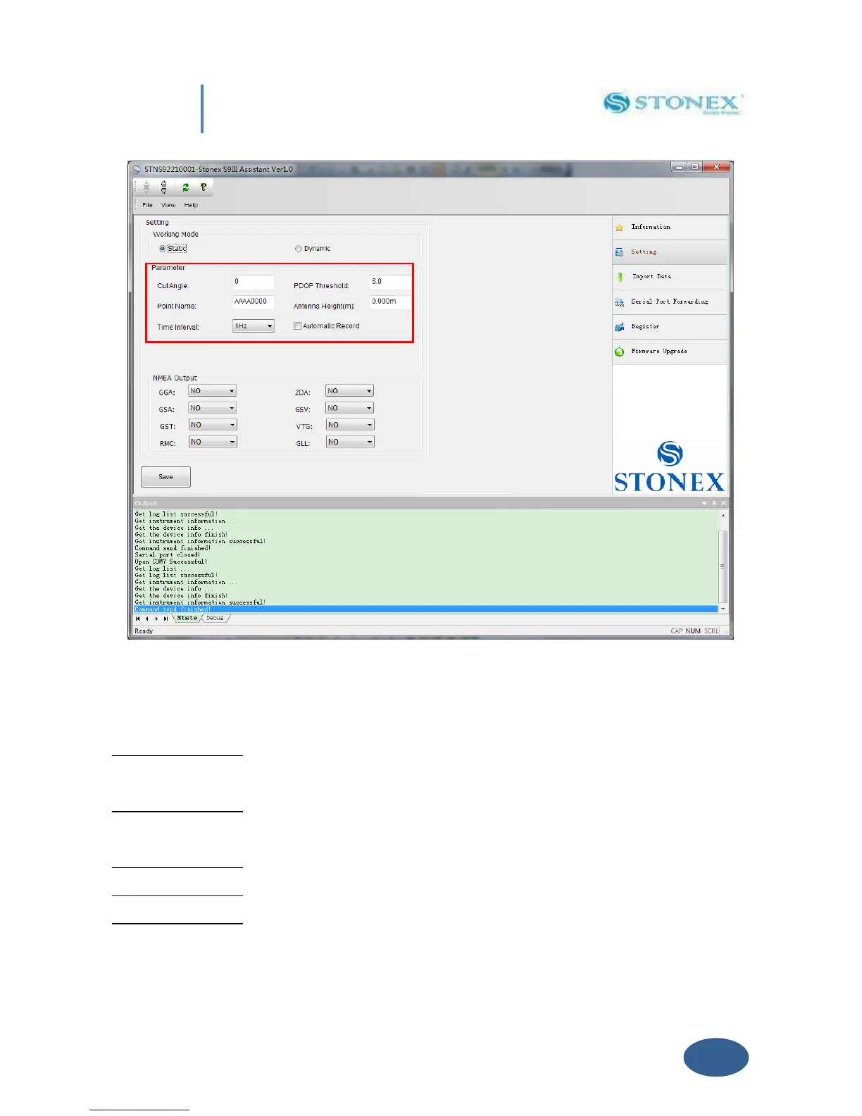
Fig. 5.5 – Static working mode
From here you can control following data settings:
Cut Angle : Define the minimum elevation of satellite to be collected in order to avoid
noisy satellites (suggested value between 20° and 10°).
PDOP Threshold : Define the maximum value of PDOP for valid GPS data in order to avoid
bad satellite configuration in the sky (suggested value below 3).
Point Name : Assign a “name” to the point you are surveying.
Antenna Height : Introduce GPS antenna height from ground, see Par IV.5 .
Time Interval : Set sampling frequency between different GPS epochs (from 60 s to 5 Hz).