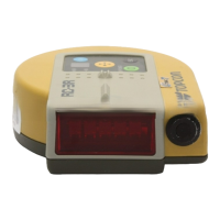
Why is the Satellite Status indicator not flashing green on Topcon mmGPS 3D Paver?
S
Shannon LongSep 1, 2025
If the Satellite Status indicator isn't flashing green on your Topcon Control Systems, first check that the antenna cable isn't cross-threaded at the antenna and is properly connected to the intermediate cable on the machine. Also, inspect the connection at the GPS antenna port on the MC-2.5 Receiver Box. If the cable is damaged, contact your dealer. Ensure the machine GPS antenna has a clear view of the sky. If this is the first connection to the MC-2.5 Receiver Box, allow several minutes for it to obtain a new almanac; the LED may not flash during this time.
A
Angela JonesAug 31, 2025
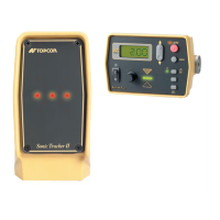
How to troubleshoot radio modem that does not power on with Topcon Control Systems?
J
Jessica GrantAug 31, 2025
If the radio modem isn't powering on with Topcon Control Systems, verify the power cable is correctly connected to the battery—RED to positive and BLACK to negative—and that the battery is charged. If the power cable is damaged, contact your dealer to purchase a new cable.
J
James AndersonAug 30, 2025
What to do if Pocket-3D is waiting for satellites in Topcon Control Systems?
S
samantha35Aug 30, 2025
If Pocket-3D is waiting for satellites with Topcon Control Systems, check the antenna cable to ensure it's not cross-threaded and is fully screwed in. If damaged, contact your dealer for a replacement. Also, ensure the antenna has a clear view of the sky, without obstructions. If this is the first connection to Legacy-E+, or after an internal reset, allow several minutes for Legacy-E+ to obtain a new almanac.
G
Gary KlineAug 28, 2025
How to troubleshoot Legacy-E+ or Hiper Lite receiver that does not power on with Topcon mmGPS 3D Paver Control Systems?
B
barnettlisaAug 28, 2025
If your Legacy-E+ or Hiper Lite receiver isn't powering on, ensure you're holding the PWR button down for at least one second; a quick press won't activate it. Also, check the power cable connection to the battery, ensuring RED is connected to positive and BLACK to negative, and that the battery is charged. Verify the RED dots on the power cable connector and the socket on the receiver are aligned, and the cable is fully inserted. If the power cable is damaged, contact your dealer for a replacement.
M
Mario PowellAug 27, 2025
What to do if the control box does not power on in Topcon mmGPS 3D Paver?
A
adam64Aug 27, 2025
If the control box for your Topcon Control Systems fails to power on, the cable might be the issue. Ensure you're using the correct cable, that it's properly connected, and undamaged. The power cable should supply 12 to 24 VDC and be negative conductive, with a socket (positive) providing 12 to 24 VDC and an E socket serving as ground. Verify the cable is connected to the correct port. If the cable is damaged, contact your dealer for a replacement.
A
Amy GrayAug 27, 2025
Why does the screen display go dim by itself on Topcon Control Systems?
O
ochoawesleyAug 27, 2025
If the screen display on your Topcon Control Systems dims by itself, there are a couple of potential reasons. First, the fan may not be rotating, leading to overheating. Check the fan; if it's not working, it may need replacement – contact your dealer. Second, the control box has a self-adjusting brightness feature. Brightness may decrease if the control box overheats due to high ambient temperatures, or if the ambient light dims. The backlight also reduces when the ambient light becomes dim.
K
Katie WalkerAug 25, 2025
What to do if the screen display turns off by itself on Topcon mmGPS 3D Paver?
M
marroyoAug 26, 2025
If the screen display on your Topcon Control Systems turns off by itself, the fan may be damaged, causing the control box to overheat. Check to see if the fan is rotating. If it is not, the fan likely needs to be replaced. Contact your dealer.
J
James RodriguezAug 23, 2025
Why does measurement take too long with Topcon mmGPS 3D Paver?
J
julian67Aug 25, 2025
If measurements are taking too long with Topcon Control Systems, the machine may be obstructing satellite signals to the antenna. Watch the measurement screen; if it says “waiting for satellites,” move the machine away from the antenna. Alternatively, the Control Point might be too close to obstructions. In this case, move to another Control Point or ask the surveyor to place a new one away from any obstructions.