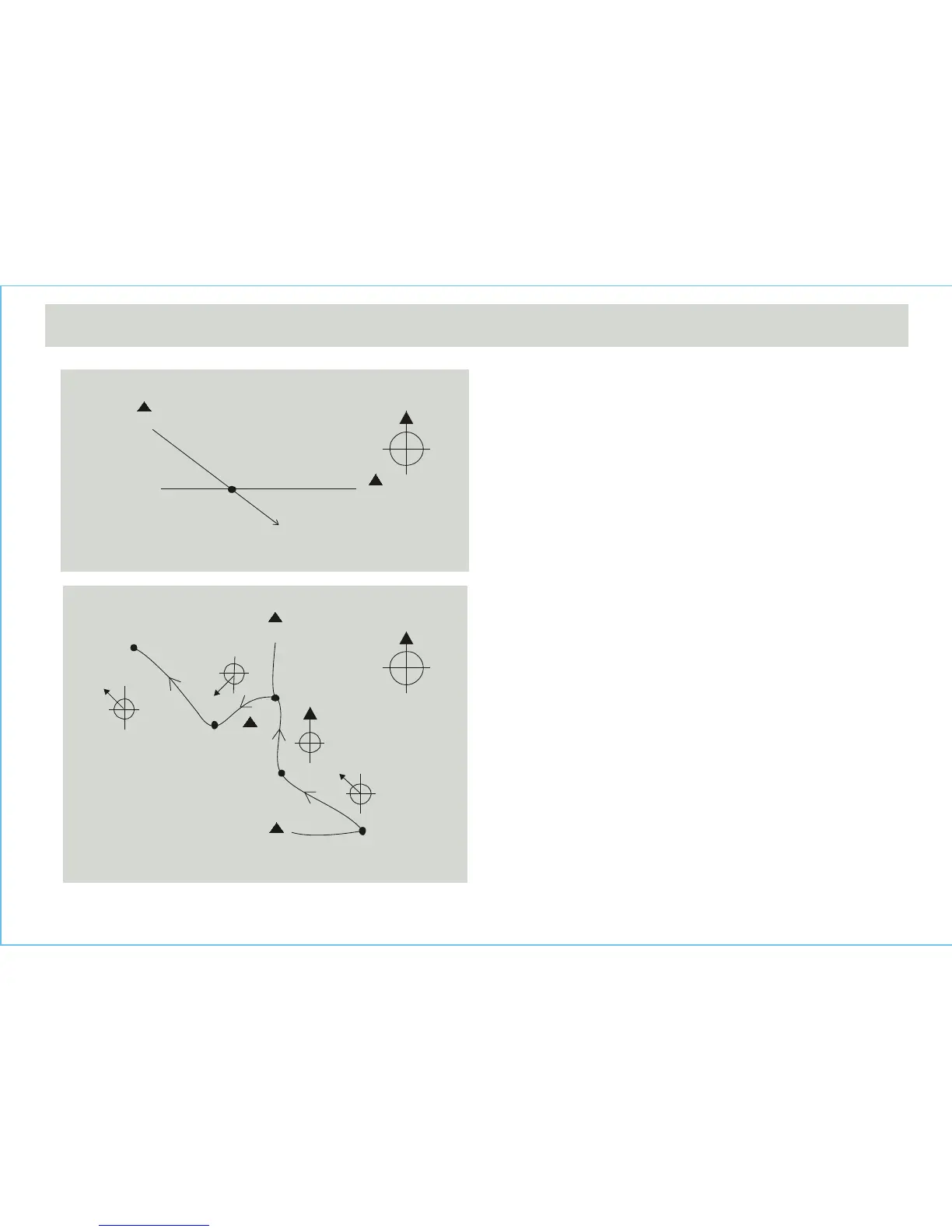
Check your position by Backward Bearing Directions
• Spot two distant identifiable landmarks like mountains,
light-house, fort or building from yourcurrent position, for
example the mountains A and B.
• Check out the backward bearing directions of mountains A and
B from your current position, for example 135° from mountain A
and 270° from mountain B.
• Use a ruler to draw a line 135° from the north at the mountain
A to your current position on the map. Draw another line 270°
from the north at the mountain B to your current position on the
map.
• Your current position on the map will be the intersection (point
A) of the lines 135° from the mountain A and 270° from the
mountain B.
The Compass Directions
• During a trekking, the Watch can keep your course in a correct
way. For example, the correct trail starts from point A and
finishes at point E as drawn on the adjacent map.
• Mark the points (identifiable landmarks) where the trail turns its
direction or the trail branches its way, such as the points A, B,
C, D and E on the adjacent map.
• Find out the bearing directions of point B from point A (315°),
point C from point B (0°), point D from point C (225°), and then
point E from point D (315°).
• During the trekking, make sure that the heading direction is
315° from point A to point B. Performing the similar checking in
other sections of the trail helps you keep your course correctly.
IMPORTANT: If you are in doubt of the directions and positions of
the trail, consult the park administration office before starting the
trekking.
12.3 Compass Mode - Applications of the Compass
4110 m
2120 m
3120 m
point A
(starting point)
point B
A Sample Trail on a Map
point D
point E
(finish point)
point C
315°
225°
0°
315°
mountain B
Check Current Position By Backward Bearing
mountain A
270°
135°
point A
0
0