4-10 Pilot’s Guide 190-02488-01 Rev. B
Planning
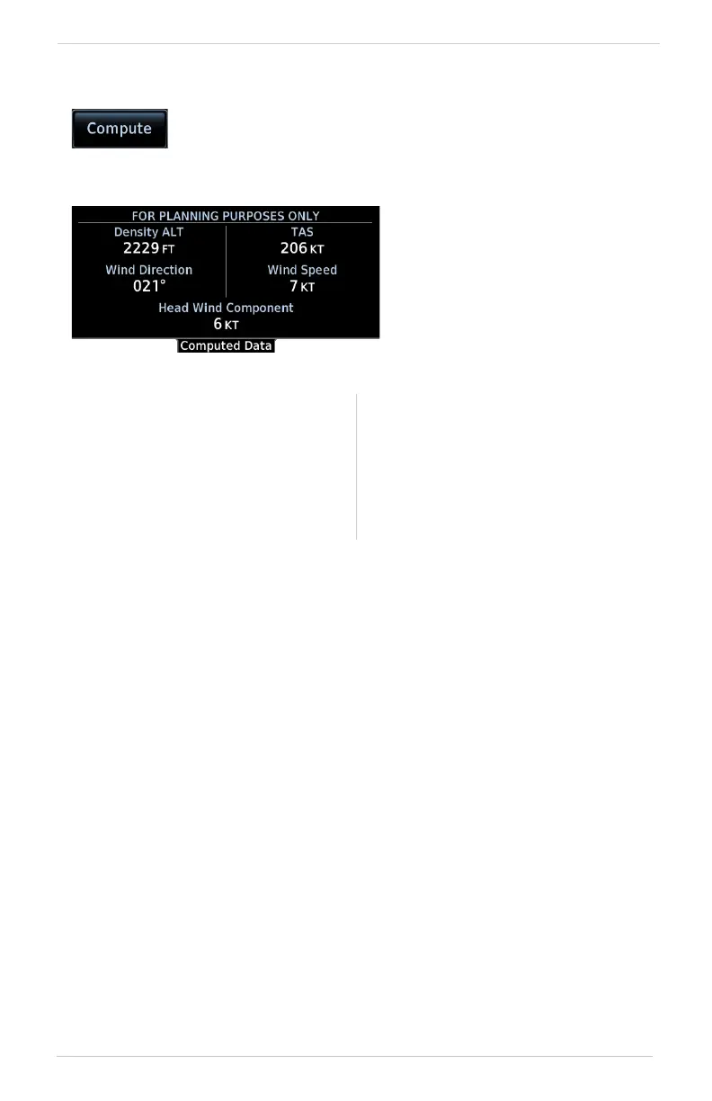
Computing DALT/TAS/Wind Statistics
Density altitude and true airspeed calculations are dependent on indicated altitude, barometric pressure,
and total air temperature.
Wind data calculations are dependent on true airspeed, aircraft heading, and ground speed.
Wind direction is dependent on the NAV Angle system unit setting.
If wind speed is zero, wind direction displays as dashes.
Density Altitude Wind Data
• Pressure altitude corrected for
nonstandard temperature
• Units display in increments of ten
• Wind direction and speed
• Headwind
• Tailwind
• True air speed
Compute and display density altitude and current wind
conditions. Calculations are based on current input values.
Statistics display on a dedicated
data page. This information is
for planning purposes only.
Dashes indicate when input
values are invalid.
 Loading...