Using the GPSMAP 60Cx
This section explains how to enter and select
information with the GPSMAP 60Cx.
Understanding Terms
As you progress through this manual, you are directed
to press a specic key or highlight a eld on the
screen. When you are directed to press a key, you
should press and quickly release the key. (You may
need to hold down a key for a period of time to start a
secondary function, when the instructions tell you to
do so.) When a eld is highlighted on the screen, it is
highlighted in yellow. The position of the highlight is
controlled by the ROCKER.
The following terms are used throughout this manual:
Highlight—move the highlighted area on the screen
up, down, left, or right with the ROCKER to select
individual elds.
Field—the location on a page where data or an option
can be shown and entered. Highlight a eld using the
ROCKER to begin entering data or selecting options.
On-screen button—use the ROCKER to highlight a
button, and press ENTER to select the button.
Scroll bar—when viewing a list of items too long to
appear on the screen, a scroll bar appears along the
right side of the list. To scroll through a list, press up
or down on the ROCKER or use Zoom In to scroll a
set of items and Zoom Out to scroll the entire screen.
Default—the factory setting saved in the unit’s
memory. You can change many settings, but you can
also revert to the factory (default) settings.
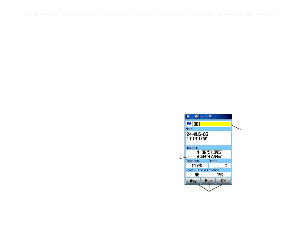
Highlighted
eld
On-screen buttons
Field
6 GPSMAP 60Cx Owner’s Manual
gettIng stArted > usIng the gPsMAP 60cx