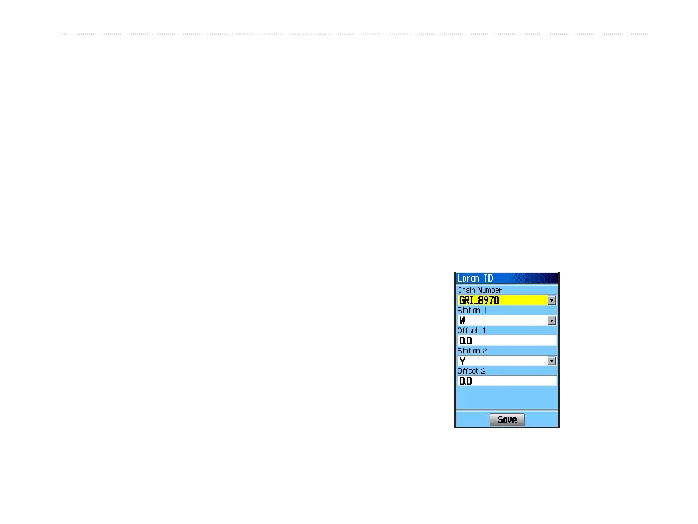
Loran TD Setup
To set up Loran TD from the Setup Menu:
1. Press the MENU key twice to open the Main
Menu.
2. Use the ROCKER to highlight the Setup icon,
and press ENTER to open the Setup Menu.
3. Use the ROCKER to highlight the Units icon,
and press ENTER to open the Units Setup
Page.
4. Highlight the Position Format eld, and press
ENTER to open the format list.
5. Highlight Loran TD, and press ENTER to open
the Loran Setup Page.
6. To change the settings of any of the ve elds,
highlight the eld, press ENTER to select from
options or enter the setting data.
7. When nished, highlight the Save button, and
press ENTER.
If the active GRI Chain, secondary stations, or offsets
have been changed since the waypoint was created,
the waypoint references the active GRI-chain and
secondary stations and adjusts the TD coordinates
accordingly. Remember that the GPSMAP 60Cx is
not relying on the LORAN signal for navigation and
actually converts the TD coordinate to a latitude and
longitude coordinate before storing the waypoint to
memory or using it for navigation. Because of this,
the unit can navigate to a TD coordinate anywhere in
the world.
You must know your GRI chain number and
secondary stations to create a LORAN TD position.
For more information, read our LORAN TD Position
Format Handbook, available on the Garmin Web site,
at http://www8.garmin.com/support/userManual.jsp.
GPSMAP 60Cx Owner’s Manual 81
APPendIx > lorAn td