Do you have a question about the Garmin GPSMAP 695 and is the answer not in the manual?
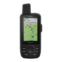
Introduces the GPSMAP 695/696 unit, its display, and primary functions.
Details the physical controls and their operational functions on the device.
Covers configuration options for display, sound, units, date/time, and other system parameters.
Explains how to access and view nearest airports, VORs, NDBs, and other facilities.
Details the VNAV feature for setting and following a vertical profile during flight.
Overviews the Navigation Map, its data, orientation, and page layout options.
Explains how to customize the data displayed in the information bars on map pages.
Describes the compass arc display on the Map Page and its configuration.
Guides on adjusting the Course Deviation Indicator scale for navigation.
Explains how to set the bug indicator for bearing or course reference.
Details how to enable, disable, and use the VNAV indicator for vertical guidance.
Explains how to set map orientation to North Up, Track Up, or Desired Track Up.
Covers changing map zoom levels and panning the map to view different areas.
Introduces the Waypoint Page for airport and waypoint information and selection.
Covers accessing nearest airports, VORs, NDBs, and other navigation aids.
Guides on selecting and viewing user waypoints and nearby airspaces.
Explains airspace alerts and their various status indicators.
Explains the Direct-to function, window, and destination selection methods.
Guides on selecting airports or waypoints using the pointer for direct-to navigation.
Introduces flight planning, storage, and data fields used in flight plans.
Details creating, adding waypoints, activating, and editing flight plans.
Explains how to adjust aircraft performance settings like cruise speed and fuel flow.
Guides on selecting and loading approach procedures into a flight plan.
Covers XM Weather services, activation, and accessing weather products on the GPSMAP 696.
Explains the NEXRAD radar system, data, and potential display abnormalities.
Describes the satellite mosaic feature for viewing cloud cover and echo tops.
Details the Winds Aloft feature showing forecasted wind speed and direction.
Explains the display of surface pressure, isobars, and pressure centers.
Describes the XM Lightning feature for displaying cloud-to-ground lightning strikes.
Explains the Storm Cells feature for visualizing storms and their projected paths.
Defines METAR and TAF formats used in weather briefings and forecasts.
Explains SIGMETs and AIRMETs for hazardous weather broadcasts.
Describes Temporary Flight Restrictions and their map representation.
Explains the Freezing Levels display for identifying icing condition altitudes.
Details the availability of current and forecast weather information.
Guides on displaying XM weather products on map and WX pages.
Explains terrain/obstacle info, color codes, and display setup.
Covers enabling/disabling terrain alerts and configuring alert parameters.
Describes aural alerts for terrain, obstacles, and descent rate, including severity.
Explains TIS traffic symbology, alerts, and volume adjustment.
Explains the SafeTaxi feature for detailed airport diagrams and taxiway information.
Describes FliteCharts terminal procedure charts and how to display them.
Explains how to adjust the zoom range for viewing FliteCharts.
Details the AOPA Airport Directory for airport statistics and services.
Covers XM Radio features, activation, and controls for the GPSMAP 696.
Guides on using the XM Audio Page for selecting channels and controlling playback.
Explains how to add and manage favorite channels for XM Radio.
Describes how to adjust audio volume using the VOLUME softkey.
Details how to hide or show the XM Audio and WX pages from the display.
Lists system messages, airspace alerts, aural alerts, and data field options.
Lists and defines the available data fields that can be displayed on map pages.
Guides on connecting power/data cables and Garmin VHF Comm Radios.
Details connecting the unit to a computer via USB and managing USB drivers.
Lists supported data formats and protocols for external device connections.
Guides on configuring TIS input and NMEA output modes.
Explains TIS limitations, comparison to TAS/TCAS, and use in VMC.
Explains how to record, view, and manage flight logs.
Describes track log recording, display, saving, and clearing.
Details configuring the heading line and using the E6B calculator.
Provides contact info, software license, and warranty details.
| Battery Life | Up to 4 hours |
|---|---|
| Waterproof Rating | IPX7 |
| Battery | Rechargeable lithium-ion |
| Connectivity | USB, Bluetooth |
| Preloaded Maps | Yes |
| Aviation Databases | Yes |
| Terrain Awareness | Yes |
| Traffic Alerts | Yes |
| Weight | 1.5 lbs |
| GPS Receiver | High-sensitivity |
| Display Type | Sunlight-readable, color TFT |
| Memory | 8 GB |
| Display Size | 7-inch diagonal |