Garmin GPSMAP 695/696 Owner’s Manual
190-00919-00 Rev. D
96
Hazard Avoidance
OverviewGPS NavigationFlight PlanningHazard AvoidanceAdditional FeaturesAppendicesIndex
SATELLITE MOSAIC
Satellite Mosaic displays infrared composite images of cloud cover taken by
geostationary weather satellites. The Satellite Mosaic provides up to seven levels of
cloud cover.
Satellite Mosaic/Cloud Tops
Data
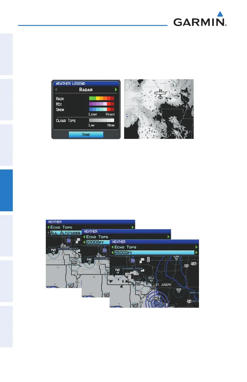
RADAR Legend
ECHO TOPS
Echo Tops are derived from NEXRAD radar and indicate the highest altitude at which
precipitation is falling. Echo Tops at or above the altitude you select are displayed, in
5,000 foot increments up to 70,000 ft. Echo Tops can be helpful in determining the
severity of thunderstorms.
Echo Tops Data