Digging to an Elevation
87
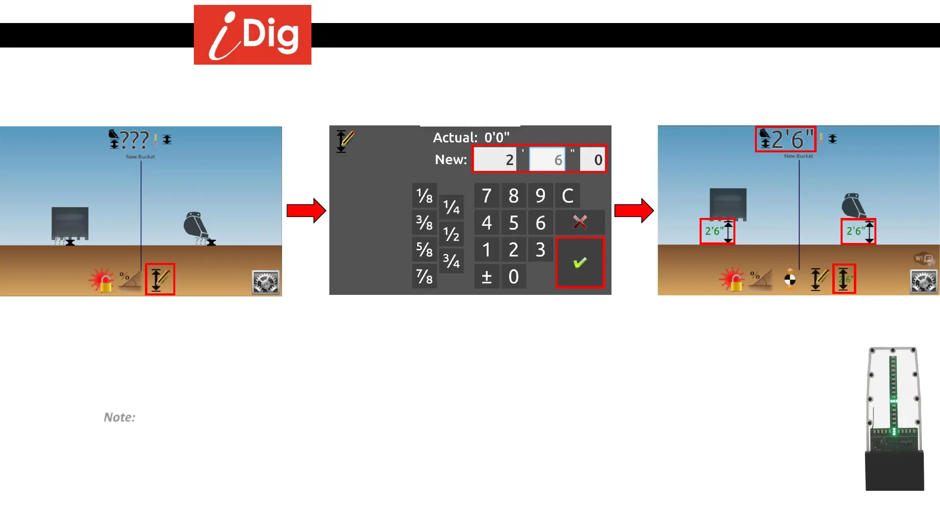
Method 2: Using a surveyor’s stake as the reference
• Place the tip of the bucket on the
surveyor’s stake or hub and then press the
“Elevation” symbol.
• Enter a positive value for the desired depth
to dig to, 2’6” in this example.
• Click on the green check mark to validate.
• The screen and the LED Display are now
giving you real-time elevation information.
Note: After the first setting of an elevation, a second icon appears on the very right hand side of
the screen: by clicking on it, you can set the last dialed-in elevation with one single click.