Magellan eXplorist Dashboard
Magellan eXplorist 310 User Manual 9
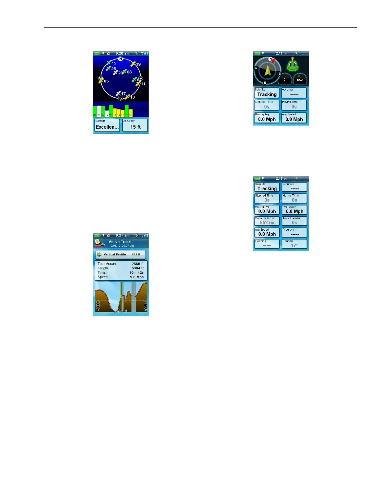
Dashboard Screen
The Dashboard Screen displays a small compass and
up to eight customisable data elds (see Customising
the Data Fields).
Data Only Screen
The Data Only Screen displays the most number of
data elds available to be viewed at one time in the
receiver. Up to 12 customisable data elds can be
viewed at one time (see Customising the Data Fields).
Satellite Status Screen
The Satellite Status screen displays a graphical
representation of the satellites overhead in relation
to you current location (the centre of the circle). The
colour of the satellite graphics, as well as the bar
graph, indicate the signal strength of the signals
being received. The numbers indicate the assigned
satellite designation. The data elds at the bottom of
the display are customisable (see Customising the
Data Fields).
Altimeter Screen
The Altimeter Screen displays detailed elevation
information using the GPS signal. The area on the
graph can be expanded by selecting the icon in the
lower right corner and dening the area to be used.
Also a line can be moved along the graph to pinpoint
an exact point on the graph and display detailed
information on that point.