6
Under the header bar is a details section that uses star ratings to indicate difficulty
and terrain and a bar graph for size. To the right is the Geocache ID (GCID)
identifier number and the date it was hidden.
Scroll and highlight the buttons below to access additional information about the
geocache. Press ENTER to view the details.
At the bottom of the page are two transparent indicators. By pressing the joystick to
the left, the product will display the highlighted point on the map and by pressing the
joystick to the right, the product will quickly create a route to the highlighted
geocache.
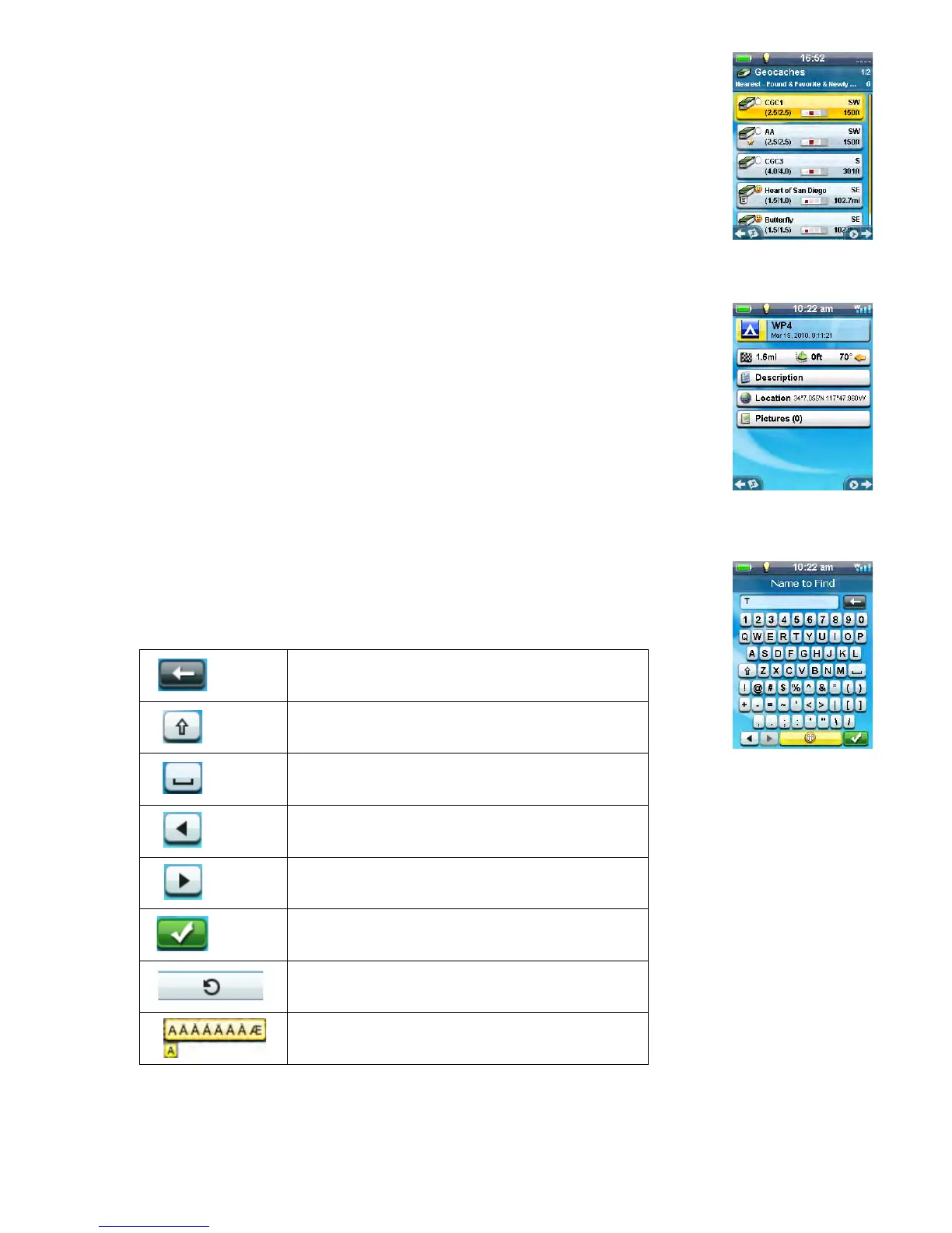
Waypoint Details
The Waypoint Details page also displays all of the known information about the
waypoint.
The header bar gives details about the waypoint using icons as well as the date and
time it was created.
Highlight the fields below the header bar to access additional information about the
waypoint. Press ENTER to view the details.
At the bottom of the page are two transparent indicators. By pressing the joystick to
the left, the receiver displays the highlighted point on the map and by pressing the
joystick to the right, the receiver quickly creates a route to the highlighted waypoint.
Keyboard
The keyboard is used to enter text or coordinate information using the joystick. With
the joystick you can maneuver around the keyboard selecting the character or value
you want entered.
Special keys:
Also remember that the ZOOM + and ZOOM - buttons can quickly move the highlight from top to bottom
or visa versa.
Backspace
Shift
Space bar
Moves cursor left
Moves cursor right
Accept
Emoticons and geocaching acronyms
Press and hold ENTER for special characters