4
The Map Screen
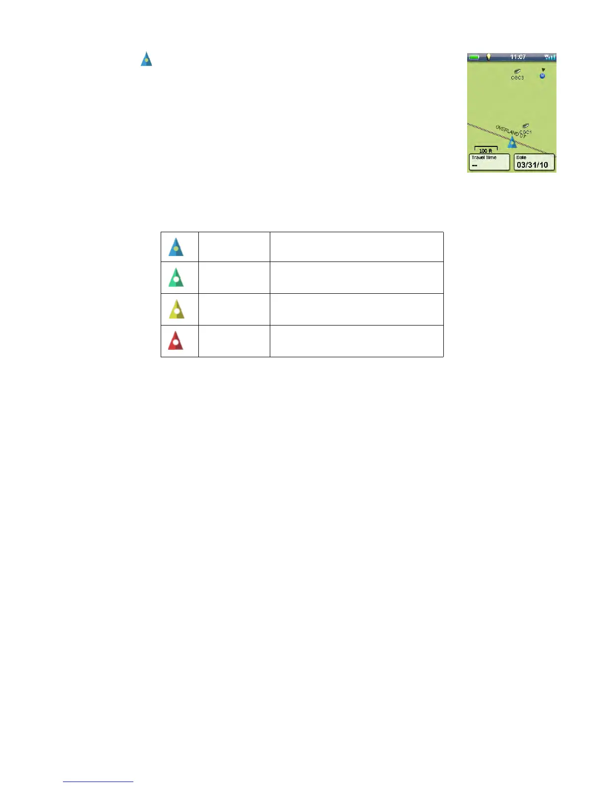
Current Location . Normally the Map screen will display your current location
against a map background. Your current location is displayed as an arrow pointing
in the direction of your current heading or last heading if you are standing still.
Pan Mode. Using the joystick you can move a cursor around the map to get pop-up
information about a displayed geocache or waypoint, visually select a point on the
map to create a waypoint, select a geocache or waypoint to route to, and view areas
of the map that may not normally be displayed due to map scale. Press the BACK
button to return the map to your current location.
Smart Arrow. By default, the Smart Arrow feature is activated, which means the
color of the arrow will change based on the direction you are heading in comparison to the bearing of your
destination. The Smart Arrow features can be turned off by accessing the Map Options in the Options
Menu.
Options Menu. The Map Screen has an Options Menu that can be displayed by pressing the MENU
button. The Options Menu's contexts will vary based on your current action, such as routing to a
destination or panning the map. Most of the common functions needed while geocaching can be
accessed easily from the Options Menu.
Navigation Data Fields. Up to four "Nav" Fields can be displayed on the Map Screen at any given time.
The number of Nav Fields and the data to display can be customized by the user by accessing the
Options Menu.
North Up or Heading Up. The orientation of the map screen can be customized to North Up or Heading
Up by accessing the Options Menu. With North Up selected, the top of the map will always be pointing
north, with Heading Up the top of the map is in the direction you are heading.
Compass Overlay. A transparent compass overlay can be displayed on the map if you select
Map+Compass in the Options Menu. A stand alone Compass Screen can be activated within the
Dashboard and you can customize the Compass Design in the Settings under Tools.
Zoom in / Zoom out. You can change the map scale by using the ZOOM + or ZOOM - buttons. By
default, the Map Screen has the Auto Zoom feature activated. This means the map scale will always
show your current location and destination on the Map Screen at the same time while routing. The Auto
Zoom feature can be turned off by accessing Map Options in the Options Menu.
Special Feature of the ZOOM +/ZOOM - Buttons: While viewing menu screens or the keyboard, the
ZOOM keys give you quick access to the top or bottom of the list.
Blue Not routing or stationary.
Green On course (heading and bearing are
the same)
Yellow Off course. Left or right of course
line.
Red Moving in the opposite direction from
your destination.