VESSEL MENU
eng 105
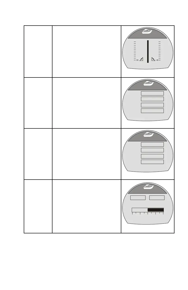
Tabs
Displays the position of the tabs
with numbers and a bar graph for
each tab.
Tabs
[ EXIT ] [ NEXT ]
36731
STBD
PORT
0.0 0.0
GPS
Displays the course over ground
("COG"), speed over ground
("SOG"), latitude position ("LAT"),
and longitude position (LON"). A
GPS must be installed for this
option to display information.
[ NEXT ]
GPS
[ EXIT ]
36642
COG
SOG
LAT
LON
O
- - -
- - -
- - -
- - -
MPH
To Waypoint
Displays the amount of time to the
waypoint, the compass bearing
towards the waypoint, the
distance to the waypoint, and the
amount of fuel required to the
waypoint. A GPS must be
installed with a SmartCraft puck
for this option to display
information.
[ NEXT ]
To Waypoint
[ EXIT ]
36645
Time
Bearing
Dist
Fuel
H
- - -
- - -
- - -
- - -
o
MI
GAL
Steering
Displays the engine RPM, the
vessel speed, a bar graph
indicating the direction of the
steering ("PORT" or "STBD"), and
a number displayed to indicate the
relative position of the steering. A
steering position sensor must be
installed for this screen to display
the steering direction and relative
position.
[ NEXT ]
Steering
[ EXIT ]
36647
PORT
SPEED
MPH
PDL
RPM
STBD
0
0.0
49
o