Using a Velocimeter 29
© 2018 Nortek AS
5. Use the Vector software to plan the deployment. Click Deployment > Planning.
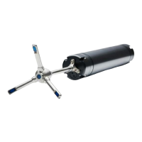
6. Install the Vector in its frame, and run a compass calibration. Click On-line > Compass
Calibration.
7. Start deployment. Click Deployment > Start Recorder Deployment (Stand-alone) or Start Data
Collection (Real-time).
8. Enter a 6-character deployment name.
9. If appropriate, set a delayed start-up time.
10. Disconnect cable and install dummy plug. Insert plug pins with silicone spray.
11. Install on site. Ensure that the acoustic beams point where you want and that they are not
obstructed. If you use a cable probe and configure the instrument to measure in ENU, please
remember that the probe and the main housing need to be aligned.
Note: If you set the Vector to collect data, remove power, and then re-apply power later, the Vector
will immediately resume data collection. Remember that the date and time may be lost if the power
is gone for some time.
Although designed primarily for autonomous deployments, the Vector may just as well be used in
monitoring applications with online connection to a remote computer. You may then set up the
Vector to record a copy of all data acquired to the internal recorder, in addition to have the data
transferred to the remote computer. This is called Recorder Data Collection, as opposed to
Deployment (see buttons in the Vector software).
The Vector may also be used together with other sensors or with a controller. When used with a
controller, the controller may serve as an external storage device (if applicable) and it may provide
power and sampling control creating a very sophisticated system. All this is treated in detail in the
Integrators Guide - Classic.
2.1.6 Mounting and Handling the Probe
It is important to remember that any motion of the instrument can significantly alter the flow
pattern and amplify the vortex-induced forces. A primary goal is thus to keep the instrument from
moving. If not, an IMU should be considered.
Self-disturbance of flow can be a source of data contamination for Vectors. Flow disturbance
affects your measurements, and significant errors can be generated when the sensor samples in
its own turbulent wake. Thus, it is important to consider the effects large objects will have on the
flow itself. A rough rule of thumb is that objects disturb the flow as far as 10 diameters away from
the object. Flow disturbance is greatest directly downstream in the wake behind the object.
Use extra attention to ensure that no part of the deployment comes in the way of the beams
(mooring line, buoy, frame, etc.). Objects in the way of the beams will corrupt the data. Objects
interfering with the beams may violate your data.
When wave measurements are of interest; usually we aim to classify the incident wave and current
field, therefore it is critical that we deploy the instrument in a location that exposes it to an
incident wave environment that is undisturbed by its surroundings. Some neighboring structures
that influence the data collection could include piers, breakwaters, unusual changes in
bathymetry, as well as rivers (or exposure to high currents). Such structures affect the local wave
field by reflections, diffraction, refraction, evanescent modes, etc. For example, an instrument
deployed in front of a breakwater would be exposed to the combined incident and reflected waves.
The PUV approach does not have the ability to separate these two fields. Therefore close
proximity to any of the above listed is discouraged, unless of course the objective of the data
collection exercise is to measure the locally influenced wave environment at the particular location
of deployment.
Make sure that there is enough return signal from the scatters in the water. The Vector needs a
certain signal-to-noise ratio, SNR to get accurate estimates. The more scattering particles there
are in the water, the better the SNR.
Mounting on or near metal that influences the magnetic field should be avoided. If this cannot be
avoided then the user can either calibrate the effects (run the compass calibration), or note the
orientation of the instrument in its deployment position (heading) so that it may be corrected
during data processing. The data can also be collected in XYZ coordinates instead of relying on
 Loading...