102
HSB Series Chartplotter
NMEA
The NMEA 0183 Data Interface Standard was developed by the
National Marine Electronics Association of America. It is an international
standard that enables equipment from many different manufacturers to
be connected together and to share information.
The information is passed in “sentences”, each of which has a three-
letter sentence identifier. When you check to see if one piece of
equipment will “talk” to another, make sure that the two pieces of
equipment both use the same sentence identifiers. For example: VTG
carries Course and Speed Over Ground data; GLL carries latitude and
longitude; DBT carries water depth; MWV carries relative wind angle
and wind speed data.
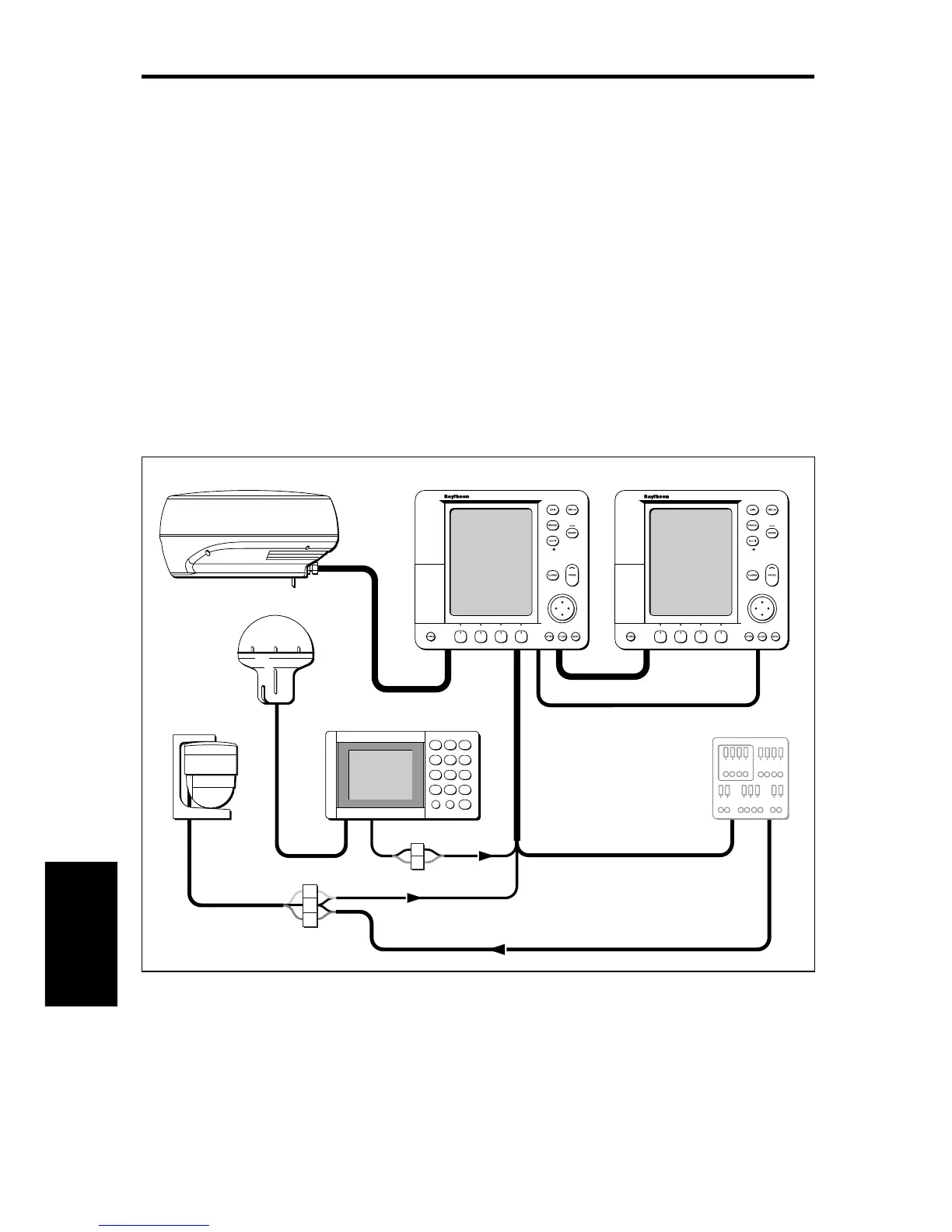
12V Supply
HSB
SeaTalk
GPS
HSB Series Display HSB Series Display
Distribution Panel
D4287-1
Scanner
NMEA
12/24V Supply
NMEA
Compass
Integrated System with Repeater Display and NMEA Instruments
Data
Standards