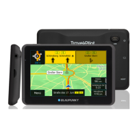
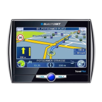
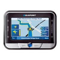
Map display during route guidance | Video display
33
The compass always points north (for ori-
entation)
Top fi eld: Name of next street
Bottom fi eld: Name of current street
The action arrow shows the next action
and the distance to that action.
When you come closer to the location of the next
action, a bar is shown on the right side: The fewer
yellow segments are displayed, the closer you are
to the location of the next action.
Voice output is activated.
Voice output is deactivated (muted).
Touching the symbol reactivates the voice
output.
Route information
Remaining distance to destination.
Estimated time of arrival
(or remaining driving time)
For tours, the information for the next interim des-
tination is shown. In addition, you can show the
distance and time for the last destination. (Set-
tings for route information: ch. "Working with the
map")
POI note
During route guidance, the device points out
your own POIs (ch. "Points of interest", "Special
POIs").
Activate the POI note in the map/navigation
settings (ch. "Working with the map").
Speed limit (signpost recognition)
The speed limit can only be shown if it is part of
the map material. Use the signpost recognition to
also acquire the speed limits in real time with the
camera.
DANGER!
Disregarding the local signpost infor-
mation and street routing can cause
accidents
The signpost recognition by the camera acquires
only the speed limit. Additional signposts or ma-
trix signing (signposts with illuminated display)
cannot be acquired.
The following conditions interfere with the sign-
post recognition:
Unfavourable lighting conditions (e.g. back
light, darkness)
Weather conditions (e.g. heavy snowfall,
thunderstorm)
Unfavourable positions or dirty signposts
High speeds of the vehicle
For this reason, always observe the local signpost
information and street routing.
The speed limit is shown in the left area of
the map. If you are driving faster than per-
mitted, the green border is shown in red.
Additional acquired speed limits are
marked on the map.
(Settings for speed limit: ch. "Working
with the map")
Note:
The speed limit can only be displayed
if it is activated in the map/navigation
settings (ch. "Working with the map").
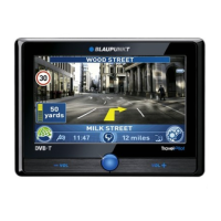
Video display during route
guidance (True Navigation)
If you selected the video display in the map/navi-
gation settings (ch. "Working with the map"), you
see a video image of your surroundings instead of
a road map and your position. The device guides
you to the destination similar to the map display.
•
•
•
•
 Loading...