42
©
2019 DJI All Rights Reserved.
Flight
Operation Environment
1. DO NOT use the aircraft to spray in winds exceeding 18 kph (11 mph).
2. DO NOT use the aircraft in adverse weather conditions such as winds exceeding 28 kph (17 mph),
heavy rain (precipitation rate exceeding 25 mm (0.98 in) in 12 hours), snow, or fog.
3. Only fly in open areas. Tall buildings and steel structures may affect the accuracy of the compass
and the GNSS signal.
4. Pay attention to utility poles, power lines, and other obstacles. DO NOT fly near or above water,
people, or animals.
5. Maintain VLOS of the aircraft at all times, and avoid flying near obstacles, crowds, animals, and
bodies of water.
6. Avoid flying in areas with high levels of electromagnetism, including mobile phone base stations and
radio transmission towers.
7. The recommended maximum operating altitude is 2 km (6,560 ft) above sea level. DO NOT fly over 3
km (9,842 ft) above sea level.
8. Once the operating altitude reaches 1 km (3,280 ft), the payload capacity of the spray tank is
reduced by 2 kg. For every additional km, the payload capacity will reduce by a further 2 kg.
9. Make sure that there is a strong GNSS signal and the D-RTK antennas are unobstructed during
operation.
10. DO NOT operate the aircraft indoors.
Flight Limits and GEO Zones
Unmanned aerial vehicle (UAV) operators should abide by the regulations from self-regulatory
organizations such as the International Civil Aviation Organization, the Federal Aviation Administration,
and their local aviation authorities. For safety reasons, flight limits are enabled by default to help users
operate this aircraft safely and legally. Users can set flight limits on height and distance.
When operating with a strong GNSS signal, the height and distance limits and GEO Zones work together
to monitor flight. With a weak GNSS signal, only the height limit prevents the aircraft from going above 30
meters.
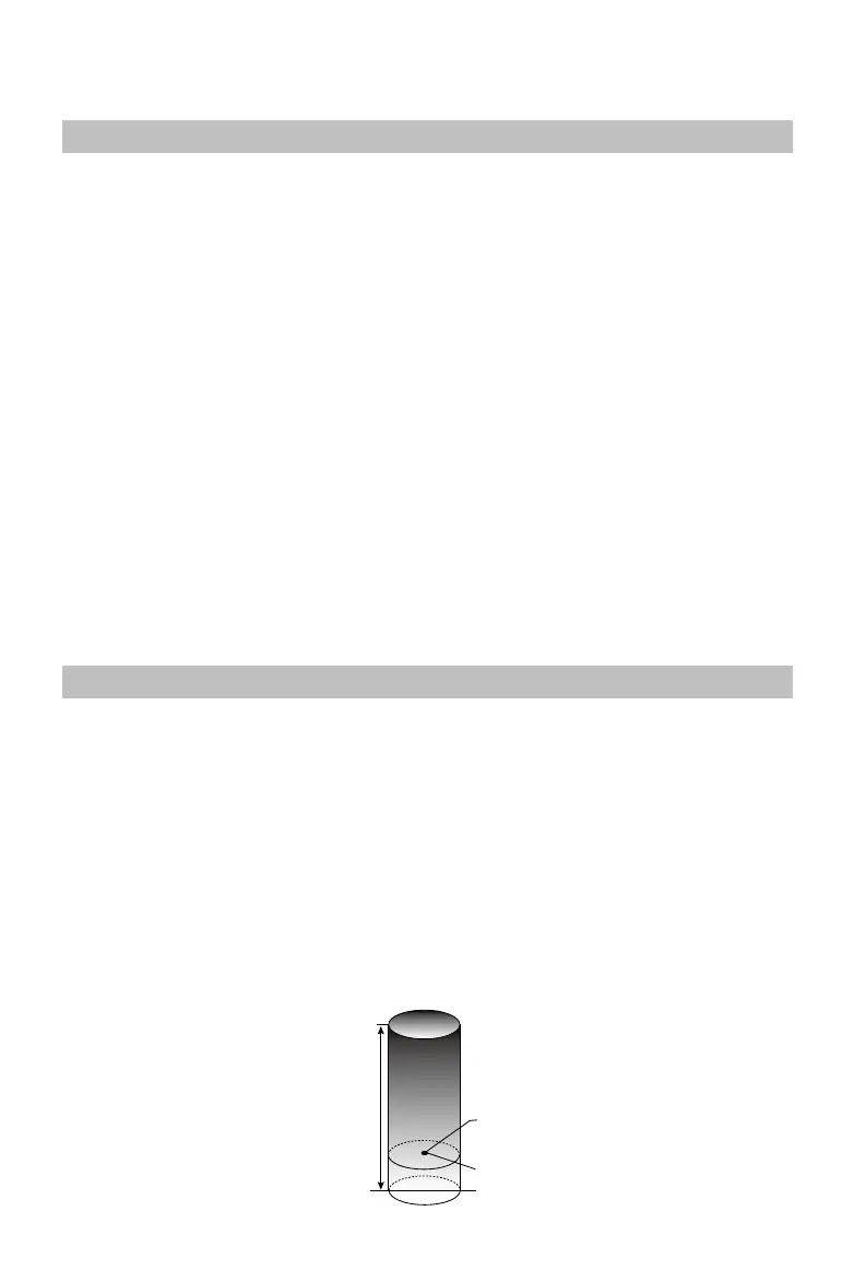
Maximum Height and Radius Limits
Users can change the maximum height and radius limits in DJI MG2. Once completed, the aircraft flight
is restricted to a cylindrical area that is determined by these settings. The tables below show the details
of these limits.
Max Flight Altitude
Max Radius
Home Point
Altitude of aircraft when powered on or the
distance of the aircraft to the surface

 Loading...