ZENMUSE L2
User Manual
©
2023 DJI All Rights Reserved.
15
L2
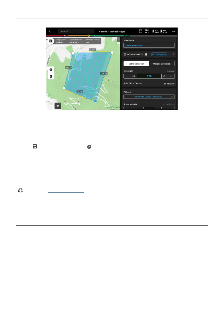
2. Choose the aircraft, and then select Zenmuse L2, LiDAR Mapping.
3. Click OK after completing the Payload Settings, then set the ight route parameters and
Advanced Settings.
4. Tap to save the task and tap to upload and execute the ight task.
5. After the ight task, users can preview the 3D models or even merging models collected
from multiple ight tasks.
6. Power o the aircraft after completing the task and remove the microSD card from the L2.
Insert the microSD card into a computer and check the point cloud data and other les in
the DCIM folder.
• Refer to Route Parameters for more information.
• For LiDAR Mapping, it is recommended to set the Side Overlap (LiDAR) to above 20%,
the Scanning Mode to Repetitive, the altitude to 150 m, the ight speed to 15 m/s, and
also to enable IMU Calibration.
• It is recommended to disable Dewarping and set Forward Overlap (Visible) and Side
Overlap (Visible) to default parameters in a Photogrammetry task.
 Loading...