Do you have a question about the Eagle 500C and is the answer not in the manual?
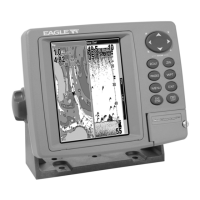
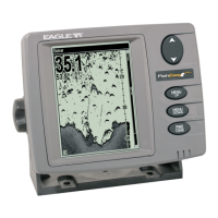
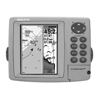
Detailed technical specifications for the FishElite 500C and SeaCharter 500CDF units.
Explanation of the principles behind sonar technology and how it detects underwater objects.
Explanation of how the Global Positioning System (GPS) determines location and provides navigation.
Overview of GPS and WAAS satellite navigation systems and their operation.
Guide on interpreting manual formatting for commands, keys, and instructions.
Steps to take before installing the sonar system.
Instructions for mounting the Skimmer transducer on a transom, trolling motor, or hull.
Lists required tools and supplies for transducer installation.
Details tools and supplies for single-frequency transom transducer setups.
Details tools and supplies for dual-frequency transom transducer setups.
Lists tools and supplies for single-frequency trolling motor transducer setups.
Lists tools and supplies for shoot-through hull transducer installations.
Guidance on choosing the optimal location for transducer mounting on a boat hull.
Advice on setting the transducer's centerline level with the boat hull for best performance.
Compares the advantages and disadvantages of two transducer mounting methods.
Step-by-step guide for assembling and mounting transom transducers.
Instructions for installing a trolling motor bracket for the transducer.
Explains how transducer angle affects fish arch display on the sonar.
Details how to prepare fiberglass hulls for shoot-thru transducer installation.
Information on connecting and using optional speed and temperature sensors.
Instructions for connecting the unit to a 12-volt battery system.
Options for installing the sonar unit using a gimbal bracket, in-dash, or portable setup.
Guide for installing the external GPS antenna and receiver module.
Explains NMEA standard communications format for marine electronics.
Details the wiring for NMEA 0183 communication port.
Instructions for installing MultiMedia Cards (MMC) or Secure Digital (SD) cards.
Mentions available accessories like switch boxes and MapCreate software.
Identifies and explains the functions of the unit's keyboard buttons.
Instructions for turning the unit on and off, and controlling backlight settings.
Overview of accessing and navigating the unit's main menu structure.
Explains the Satellite Status Page for monitoring GPS satellite lock-on.
Describes the Navigation Page for directional guidance and compass information.
Details the Map Page for viewing charts, routes, and your position.
Details the Sonar Page display and its functions for viewing sonar data.
A concise, step-by-step guide for basic sonar operation and fish finding.
Discusses basic sonar operation, including sensitivity adjustments.
Compares using Fish I.D. symbols versus interpreting raw sonar arches.
Noise rejection system to improve sonar display quality.
Configuration for sonar alarms like depth, zone, and fish alarms.
Audible alarm for detected fish symbols using the Fish I.D. feature.
Adjusts the speed sensor for accurate speed and distance readings.
Controls the scrolling rate of sonar echoes on the display.
Distinguishes between strong and weak echoes for bottom composition analysis.
Allows customization of data boxes on various page displays.
A tool to pinpoint the depth of targets on the sonar display.
Sets the sonar depth range automatically based on water depth.
Allows manual selection of sonar depth ranges from 5 to 4,000 feet.
Converts sonar echoes to horizontal lines for stationary fishing.
Identifies and displays fish targets with symbols and depth.
Shows the depth of fish symbols when Fish I.D. is active.
Allows selection of transducer frequencies (50/200 kHz) for optimal performance.
Controls screen refresh and chart scroll speed for high-speed operation.
Enables saving sonar data to an MMC for later playback.
Part of ASP, reduces unwanted signals from electrical or mechanical sources.
Allows floating GPS or navigation data to be displayed on screen.
Controls ping rate and enables HyperScroll for faster screen updates.
Resets all features, options, and settings to original factory defaults.
Resets the water distance calculation to zero.
Calibrates depth readings to account for transducer mounting position relative to the keel.
Adjusts the unit's ability to pick up sonar echoes.
The default sonar display mode showing the water column.
Displays the sonar chart with a zoomed view on one side.
Shows sonar chart with large digital data boxes for various information.
Allows customization of the digital data boxes displayed on screen.
Displays map and sonar screens side-by-side.
Allows practicing unit functions without actual sonar data.
Turns off the sonar and stops the chart from scrolling.
Controls surface clutter by adjusting receiver sensitivity near the surface.
Features for enlarging display details and a bar indicating zoom range.
Allows moving the zoomed area up and down the water column.
Troubleshooting steps for when the unit fails to power on.
Solutions for issues like unit freezing, locking up, or erratic operation.
Troubleshooting steps for poor bottom echo, erratic depth readings, or missing fish signals.
Addresses issues with bottom echo loss at speed or erratic readings.
Steps to take if fish arches are not visible when Fish I.D. is disabled.
Guidance on identifying and minimizing electrical noise affecting sonar performance.
Identifies and explains the functions of the unit's GPS keyboard buttons.
Instructions for turning the GPS unit on and off, and controlling backlight.
Overview of accessing and navigating the unit's GPS main menu.
Details the Sonar Page display, accessed via GPS Pages menu.
Explains the Satellite Status Page for monitoring GPS satellite lock-on.
Describes the Navigation Page for directional guidance and compass information.
Details the Map Page for viewing charts, routes, and your position.
A concise guide for basic GPS operations and navigation.
Steps to determine the unit's current location using GPS satellites.
Explains how to navigate and zoom the map display using arrow keys.
How to select map items like POIs or features using the cursor.
Procedures for creating and saving waypoints at current position, on map, or by entering coordinates.
Instructions for navigating to a selected waypoint using Find Waypoint commands.
Feature to mark the location of a man overboard incident for rescue.
Guidance on navigating back to the MOB position using Navigation or Map Page.
How to navigate to any location selected by the map cursor.
Process for automatically creating and saving a trail of your travel path.
Methods for following a saved trail, including visual trailing and route navigation.
Information on creating, saving, and managing routes composed of waypoints.
Procedures for creating routes directly on the unit or via PC software.
How to remove a route from the unit's memory.
Instructions for changing the name of an existing route.
Steps for adding or removing waypoints from a route.
Guide on following a saved route, including arrival alarms.
How to follow a route in the reverse direction, from end to start.
Overview of trail options for recording and displaying travel paths.
Steps to erase a specific trail from memory.
How to change the name of a saved trail.
Option to modify the display color of a trail.
Option to change the visual pattern (e.g., dotted line) of a trail.
Access to various useful tools like alarm clock, calculators, and timers.
Comprehensive guide to managing waypoints, including deletion and editing.
Procedures for removing waypoints from the list or map.
Options for editing waypoint name, symbol, and position.
How to select a waypoint on the map for navigation or editing.
Configuration for GPS alarms like arrival, off-course, and anchor alarms.
How to view files and available storage on the MMC card.
Settings for configuring the unit's communication port for data transfer.
Settings for selecting specific NMEA sentences for data transmission.
Options for choosing display formats for position coordinates (degrees, UTM, etc.).
System for finding position relative to a reference point on a paper map.
Allows customization of data boxes on Satellite Status, Navigation, and Map pages.
A tool for practicing GPS operations and navigation scenarios.
Option to force the unit to require WAAS for valid position reporting.
Adjustments for display contrast and brightness levels.
Selection of the user interface language from multiple options.
Setting the unit's local time for accurate arrival time estimations.
Option to enable or disable alarms for WAAS signal acquisition or loss.
Displays the current operating system software version of the unit.
Customization of sounds for key presses and alarms, including volume and style.
Feature to prevent trail wandering, especially at low speeds.
Settings to manage trails, including update criteria, visibility, and deletion.
Adjusts the transparency level of menu windows for better screen visibility.
Selection of units for speed, distance, depth, temperature, and heading.
Search for specific street addresses within a city or area.
Locate specific streets or intersections by name.
Select and get information on any map item by moving the cursor over it.
Search for highway exits, services, and related information.
Search for various points of interest like lodging, restaurants, and attractions.
Search for existing waypoints by name or nearest location.
Lists the various geodetic datums supported by the unit for map and chart referencing.
Information on how to get technical support, repairs, or service for the product.
Details on how to order optional accessories like cables and transducers.
Guidelines for preparing and shipping the product for repair or replacement.
| Display Resolution | 480 x 480 pixels |
|---|---|
| Waterproof Rating | IPX7 |
| Transducer Included | Yes |
| Display Size | 5 inches |
| Display | Color TFT |
| Sonar Frequency | 200 kHz |
| Frequency | 200 kHz |