Do you have a question about the Flymaster GPSm and is the answer not in the manual?
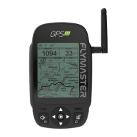
Essential element for system communication, risk of invisibility.
Securely tighten antenna clockwise to the thread end.
Force instrument reboot by pressing power and menu/esc buttons.
Restore firmware via Flymaster Instrument Manager if device fails to start.
View battery level and charging status on power-up or settings screen.
Optimize battery health through proper charging and avoiding extreme temperatures.
Use cursor buttons to select operations and ENTER to confirm or enter sub-menus.
Navigate lists with UP/DOWN, change values with UP/DOWN, confirm with ENTER.
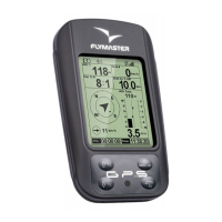
Displays primary flight data including altitude, speed, and vario.
Shows airspace information like distance to CTR and status.
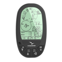
Displays thermal-related data such as ground altitude and active waypoint.
Features altitude, speed, and map view for route navigation.
Includes altitude, speed, AGL, and map view for road navigation.
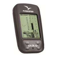
Presents altitude, speed, AGL, and a cut-side view of terrain.
Select a waypoint to add it to the route and configure task point options.
Add a new waypoint using current position coordinates and altitude.
Modify waypoint properties like name, elevation, latitude, and longitude.
Reset to factory defaults or load factory settings.
Configure landing auto-off, view user, serial number, battery status, and firmware.
Manage charging modes, time, current, and view diagnostic codes.
Calibrate altitude by entering known location altitude to calculate QNH.
Automatically set altitude using GPS data, or set to Auto for automatic updates.
Provides alarm or voice warning for approaching or crossing a turnpoint.
Siren and voice warnings for entering buffer zones near airspaces.
Siren and voice warnings for approaching or entering altitude limits.
Set horizontal (distance) and vertical (altitude) thresholds for airspace warnings.
Configure altitude to ignore, reference altitude, enable/disable warnings, and line appearance.
Choose the desired interface language.
Set units for altitude, rate of climb, speed, distance, and temperature.
Jump directly to a selected page on the flight screen.
Prevent a page from being displayed when toggling through pages.
Select datum models (WGS 84 or FAI sphere) for accurate distance reporting.
Sort waypoints list by distance or alphabetically.
Rate of descent at which a low-frequency sink sound is emitted.
Rate of climb at which the vario starts beeping.
Keep vario quiet until a Start Flight is detected.
Define minimum GPS speed to initiate flight and related functionalities.
View satellite signal strength, number of visible/used satellites, and PDOP.
Reset GPS status to start a new satellite search.
Update instrument firmware automatically via USB connection.
Create, open, save, delete, and rotate page layouts.
Send layouts to the instrument and configure page triggers.
Add and configure various objects and data fields for layouts.
| Water Resistance | IPX7 |
|---|---|
| Display Resolution | 320 x 240 pixels |
| GPS | Yes |
| Vario | Yes |
| Altimeter | Yes |
| Connectivity | USB |
| Update Rate | 1 Hz |
| GPS Accuracy | 2.5 meters |
| Display Type | LCD |
| Battery Type | Li-Ion |
| GPS Receiver | High sensitivity |
| Operating Temperature | -10°C to 50°C |