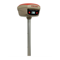
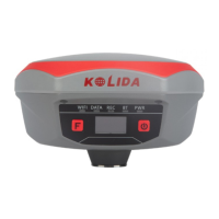
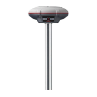
K20s
Appendix A KOLIDA K20S technical specifications
GNSS characteristics:
■ 692 GNSS channels
- GPS L1C/A, L1C, L2C, L2E, L5
- GLONASS L1C/A, L2C/A, L2P, L3
- BeiDou B1, B2, B3
- Galileo GIOVE-A, GIOVE-B, E1, E5A, E5B
- SBAS L1C/A, L5
■ Initialization:
Time <10s, reliability >99.99%
■ Supported data formats:
RTCM 2.1, RTCM 2.3, RTCM 3.0, RTCM 3.1,RTCM 3.2, CMR, CMR+
■ Output data formats:
NMEA 0183, PJK plane coordinates, Binary code,Trimble GSOF
Inertial Measurement (Model K20s IMU)
■ Tilt Angle: up to 60 degrees
■ Accuracy: down to 2cm
Positioning Accuracy
Code differential GNSS positioning
■ Horizontal: ±0.25m+1ppm
■ Vertical: ±0.50m+1ppm
■ SBAS positioning accuracy: Typically<5m 3DRMS
Static
■ Horizontal: ±2.5mm+0.5ppm
■ Vertical: ±5mm+0.5ppm
Real-time kinematic (RTK)
■ Horizontal: ±8mm+1ppm
■ Vertical: ±15mm+1ppm
Network RTK
■ Horizontal: ±8mm+0.5ppm
■ Vertical: ±15mm+0.5ppm