Chapter 2 - Mission Menu TM00358 Rev. A
October 2007 L-3 WESCAM
44 All Rights Reserved
2.12 MISSION MENU
The Mission menu provides status information and controls for configuring mission data, such as date and time or
setting preferences for readout units of measure. For example, the operator may prefer to have altitude measured in
meters as opposed to feet.
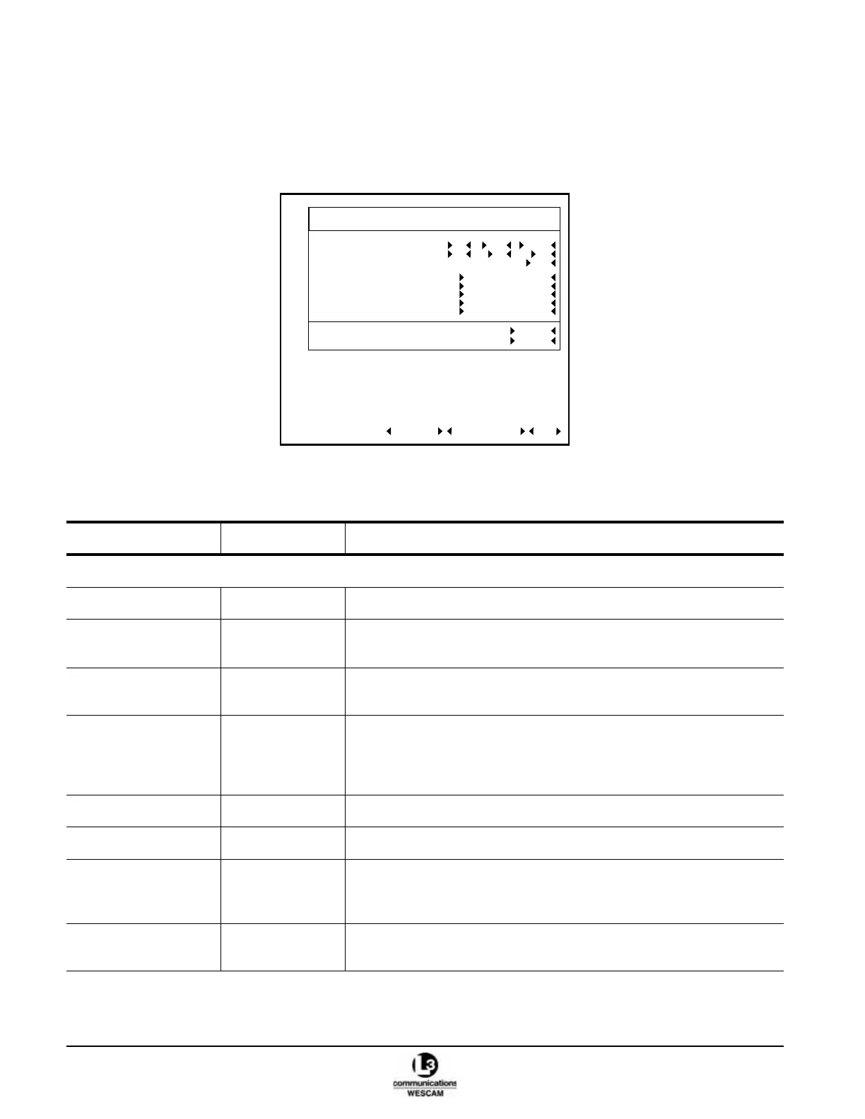
Figure 2-29 Level 2 Mission Menu
Table 2-13 Status Information and Controls in the Level 2 Mission Menu
Field Values Description
VALUE FIELDS
DATE DD, MM, YYYY Selects date options. All are set by the SET TIME action field.
LOCAL TIME Hours, Minutes,
Seconds
Selects time options. All are set by the SET TIME action field.
UTC OFFSET ±16 Sets the Greenwich Mean Time regional differential value in ½ hour
increments.
AIRCRAFT LOCATION
TARGET LOCATION
Decimal Degs,
Degs:Min:Min,
Degs:Min:Secs,
MGRS
Sets the display format for location data to:
• one of three degrees options
• Military Grid Reference Survey.
AIRCRAFT ALTITUDE Feet, Meters Sets the display units for altitude data.
TERRAIN ALTITUDE Feet, Meters Sets the display units for elevation data.
SLANT RANGE Feet, Miles,
Nautical Miles,
Meters, Kilometers
Sets the display units for distance data.
TERRAIN ALTITUDE
SOURCE
MANUAL, MAP Sets the source for terrain measurement data.
LEVEL 2 - MISSION
AIRCRAFT LOCATION DEGS:MIN:SECS
DATE 08 MAY 2006
LOCAL TIME 05 11 55
UTC OFFSET 5.0
TARGET LOCATION DEGS:MIN:SECS
AIRCRAFT ALTITUDE FEET
TERRAIN ALTITUDE FEET
SLANT RANGE NAUTICAL MILES
TERRAIN ALTITUDE SOURCE MANUAL
TERRAIN ALTITUDE 300
SET TIME FACTORY DFLT DONE
 Loading...