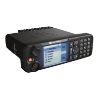
Enhancing GPS Performance
Sometimes the GPS feature is unable to complete a location calculation successfully. You hear an audible tone
indicating that your radio cannot see the satellites.
The GPS feature works best where there is nothing between your radio and a large amount of open sky. To maximize
the ability of your radio to determine a location fix, avoid closed space, tall buildings, and foliage. If possible, do not
use GPS in underground parking lots, tunnels, under bridges, and close to high buildings.
Enabling GPS
Procedure:
1 From the home screen, press the MENU key.
2 Select More . . . → Location → Interface.
3 Select On.
Note: Your service provider can enable this feature.
GPS Icon
When GPS is enabled, the following icon is displayed in the status icon area:
GPS Different Location Displays
Table 13: Different Location Displays
Latitude / Longi-
tude
UK Coordinates Irish Coordinates UTM Coordinates
MGRS Coordi-
nates
Time Time Time Time Time
Latitude 2–Letter Code 1–Letter Code 3–Letter Code 3–Letter Code and 2–
Letter Code
Longitude Easting and Northing
Coordinate
Easting and Northing
Coordinate
Easting and Northing
Coordinate
Easting and Northing
Coordinate
Altitude Altitude Altitude Altitude Altitude
Satellites Satellites Satellites Satellites Satellites
• Time — indicates when the last time the location was calculated. The time is provided in Universal Time
Coordinated.
• Letter Code — grid zone or square on the map for different coordinate standard
• Latitude — expressed in degrees, minutes, and seconds.
• Longitude — expressed in degrees, minutes, and seconds.
• Number of satellites — used to calculate the location. In general, more satellites make for better accuracy. The
maximum is 12 satellites.
52 | GPS Location Service
Send Feedback | |