RS-LiDAR-32 User Manual
2 Introduction
RS-LiDAR-32, launched by RoboSense, is the first of its kind in China, world leading 16-beam miniature
LiDAR product. Its main applications are in autonomous driving, robot-environment perception and UAV
mapping.
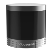
RS-LiDAR-32, as a solid-state hybrid LiDAR, integrates 32 laser/detector pairs mounted in a compact
housing.
Unique features include:
Measurement range of up to 200 meters
Accuracy: within ± 3 cm
Data rate of up to 600,000 points/second
Horizontal Field of View (FOV) of 360°
Vertical Field of View (FOV) of -25°~+15°
The compact housing of RS-LiDAR-32 mounted with 32 laser/detector pairs rapidly spins and sends out
high-frequency laser beams to continuously scan the surrounding environment. Advanced digital signal
processing and ranging algorithms calculate point cloud data and reflectivity of objects to enable the
machine to “see” the world and to provide reliable data for localization, navigation and obstacle
avoidance.
Figure 1: RS-LiDAR Imaging System.
Operation of device include:
Establish communication with RS-LiDAR-32;
Parse the data packets for azimuth, measured distance, and reported calibrated reflectivity;
Calculate X, Y, Z coordinates from reported azimuth, measured distance, and vertical angle;
Store the data as needed;
Read current device configuration data;
Set Ethernet, time and rotational speed as needed.
 Loading...