Specifications
All Models
Specification Measurement
Material Polycarbonate plastic
Water rating IEC 60529 IPX7
6
Temperature range From -15° to 55°C (from 5° to 131°F)
Input voltage From 9 to 18Vdc
Fuse 3A, 125V fast-acting
Compass-safe distance 65cm (25.6in.)
NMEA 2000 LEN @ 9Vdc 1
NMEA 2000 draw 75mA max.
Memory card 1 microSD card slot; 32 GB max. card size
Max. waypoints 5,000
Max. routes 100
Max. active track points 50,000 points, 50 saved tracks
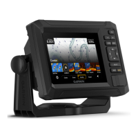
6-Inch Models
Specification Measurement
Dimensions on cradle and bail mount with swivel base (W x H x D) 21.8 x 13.0 x 6.2cm (8.6 x 5.1 x 2.6 in.)
Display size (W x H)
13.7 x 7.7cm (5.4 x 3.1in.)
15.2cm (6.2in.) diagonal
Display resolution WVGA, 400 x 800pixels
Weight 0.75kg (1.6lb.)
Compass-safe distance 65cm (25.6in.)
Clearance to nearest obstruction 8.0cm (3.14in.)
Max. power draw 12W
Typical current draw at 12Vdc (RMS) 0.7A
Max. current draw at 12Vdc 1.25A
Wireless frequency 2.4 GHz @ 17.2 dBm maximum
6
The device withstands incidental exposure to water of up to 1m for up to 30min. For more information, go to www.garmin.com/waterrating.
118 Appendix
 Loading...


