Garmin G1000 Cockpit Reference Guide for the Socata TBM 850
190-00708-00 Rev. A
10-29
SECTION 10 – HAZARD
AVOIDANCE
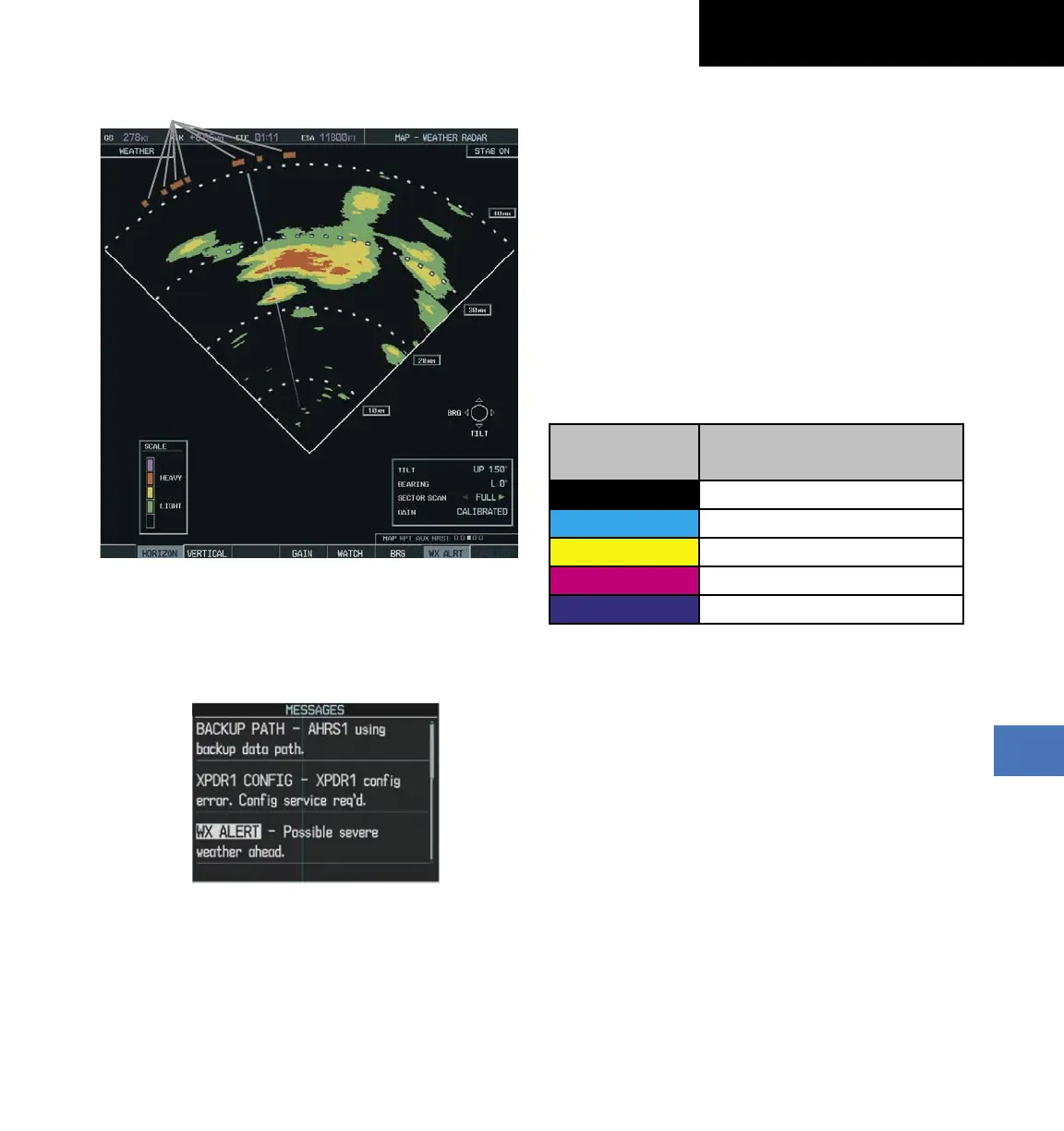
Figure 10-46 Weather Alert Indications
Weather Alerts
To activate or deactivate Weather Alerts, select the WX
ALRT Softkey. Activating and deactivating also enables or
inhibits the alert on the PFD.
Figure 10-47 Weather Alert on PFD
Ground Mapping and Interpretation
A secondary use of the weather radar system is for
the presentation of terrain. This can be a useful tool for
verifying aircraft position. A “picture” of the ground is
represented much like a topographical map that can be
used as a supplement to the navigation map on the MFD.
Ground Map mode uses a different gain range than
Weather mode. Different colors are also used to represent
the intensity levels. The displayed intensity of ground
target returns are defined in Figure 10-48. Use of the
GAIN and TILT controls help improve contrast so that
specific ground targets can be recognized more easily. As
previously discussed, the type and orientation of the target
in relation to the aircraft affects the intensity displayed.
When the weather radar system is in the either the
Weather or Ground Map mode, the system automatically
switches to Standby mode.
Ground Map
Mode Color
Intensity
BLACK 0 dB
LIGHT BLUE > 0 dB to < 9 dB
YELLOW 9 dB to < 18 dB
MAGENTA 18 dB to < 27 dB
BLUE 27 dB and greater
Figure 10-48 Ground Target Return Intensity Levels
Operation in Ground Map Mode
1)
Select the
MODE Softkey.
2)
Select the GROUND Softkey to place the radar in
Ground Map mode.
3)
Select the BACK Softkey.
4)
Press the FMS Knob to activate the cursor.
5)
Turn the large
FMS Knob to place the cursor in the
TILT field.
6)
Adjust the antenna tilt angle by turning the small
FMS Knob to display ground returns at the desired
distance.
7)
Press the FMS Knob to remove the cursor.

 Loading...


