Garmin G1000 Cockpit Reference Guide for the Socata TBM 850
190-00708-00 Rev. A
SECTION 7 – NAVIGATION
7-1
SECTION 7: NAVIGATION
The majority of the following discussions pertain to
the Multi Function Display. In discussions pertaining to
the PFD, the controls are located on the PFD.
7.1 NAVIGATION MAP PAGE
WARNING: The map display should only be
used for situational awareness. Any map display
indication should be compared with approved
navigation sources.
Select the MAP Page Group
1)
Turn the large
FMS
Knob until
‘
MAP’ is highlighted
in the page group box in the lower right of the MFD
display.
2)
Turn the small
FMS
Knob to select the first MAP
page (indicated by a solid rectangular icon).
Figure 7-1 Navigation Map Page (Enroute)
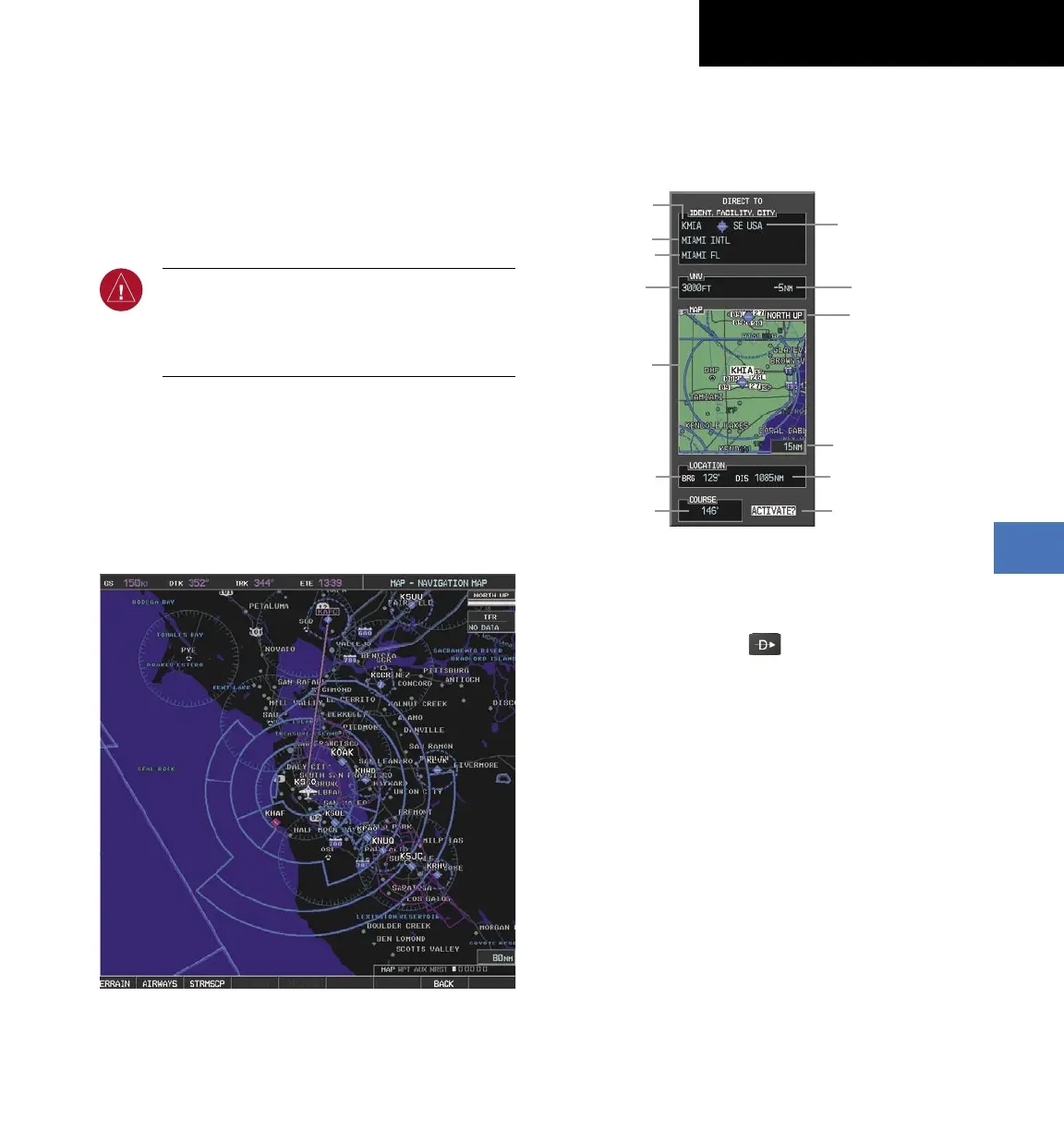
7.2 DIRECT-TO NAVIGATION
Direct-to Navigation from the MFD
Identifier
Facility Name
City
Map of the
Selected
Waypoint
Bearing
Distance
Direct-to
Course
Geographic
Region
VNV Target Altitude
Offset Before Selected
Direct-to
Map Orientation
Map Range
VNV
Target Altitude
Activate Field
Figure 7-2 MFD Direct-to Window
Enter a Direct-to Destination
1)
Press the
Direct-to
( )
Key.
2)
Enter the destination waypoint identifier.
3)
Press the
ENT
Key to confirm the identifier. The
‘Activate?’ field is highlighted.
4)
If no altitude constraint or course is desired, press
the
ENT
Key to activate. To enter an altitude
contraint, proceed to step 5.
5)
Turn the large
FMS
Knob to place the cursor over
the ‘VNV’ altitude field.
6)
Enter the desired altitude.
7)
Press the
ENT
Key. The option to select ‘MSL’ or
‘AGL ‘is now displayed.
8)
Turn the small
FMS
Knob to select ‘MSL’ or ‘AGL’.

 Loading...


