Leica DM2000, Software
30
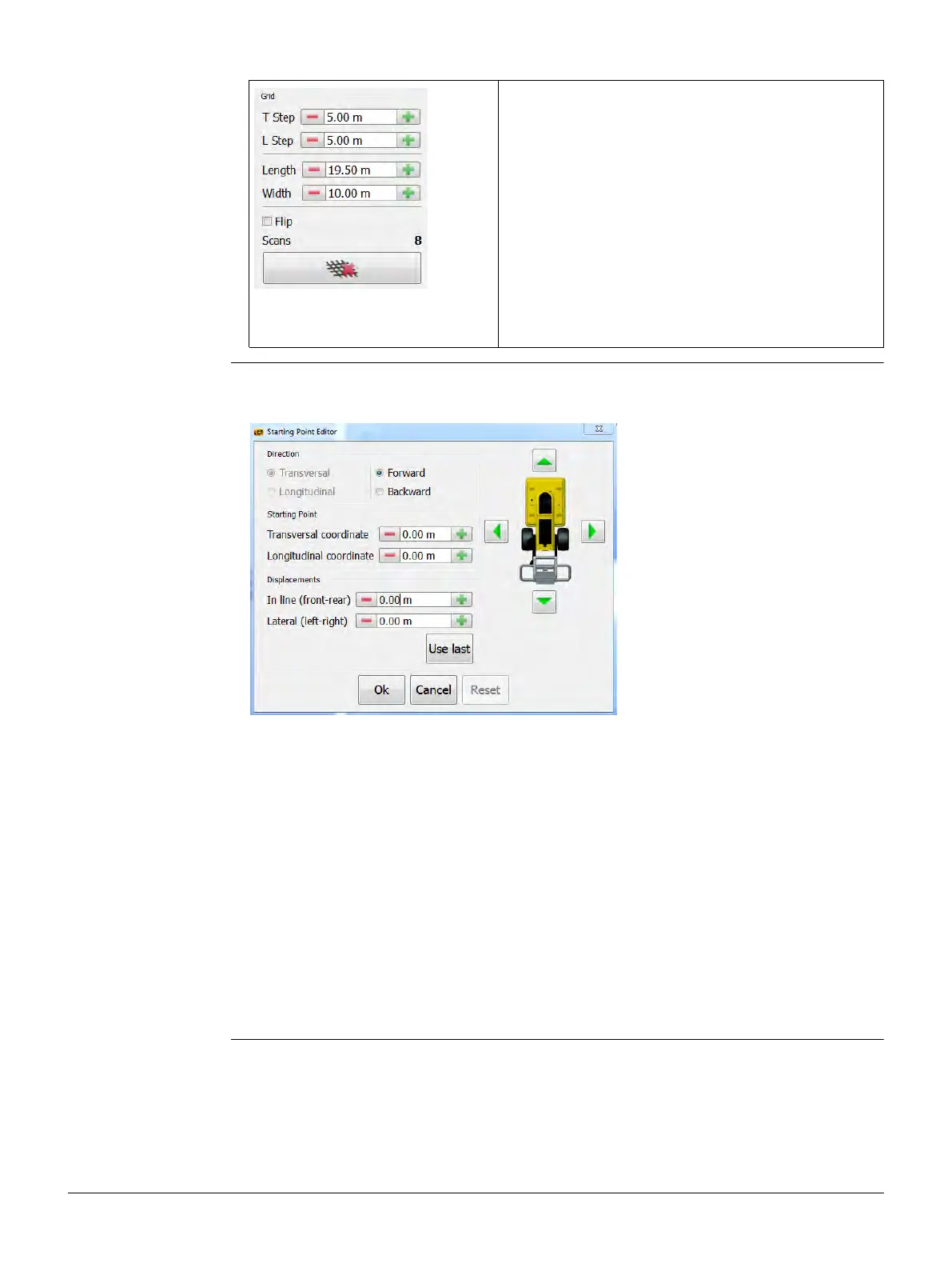
Modifying the Grid Settings
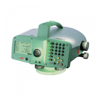
Starting Point Editor With the Starting Point Editor you can change the position of the DS2000 in relation
to the measurement grid within the map.
In the Grid section you can define the following
parameters:
• T Step: Distance between two grid lines in the
transversal direction.
• L Step: Distance between two grid lines in the
longitudinal direction.
• Length: Total length of the grid.
• Width: Total width of the grid.
• Flip: Option to flip the grid 180°.
The field Scans displays the total number of scans
that are necessary to complete the survey.
To reset the grid to the default, click the
button beneath the Grid section.
Direction:
This section displays the direction of the selected scan line and the currently selected
scan direction.
Select the desired scan direction for the data acquisition (forward or backward).
Starting Point:
In this section, you can edit the coordinates of the starting point.
To edit the values, click the green arrows in the interactive graphic or click the plus or
minus buttons.
Displacements:
In this section, you can edit the in-line and lateral displacements.
To edit the values, click the green arrows in the interactive graphic or click the plus or
minus buttons.
Note: The Starting Point and Displacements values are interdependent.
Changing the values of one section changes the values of the other section
accordingly.