Leica DM2000, Software
29
4.3.4 Data Acquisition with the New Assisted Project Function
Starting an acquisi-
tion
The length of a single scan must not exceed 800 m.
Setting up a meas-
urement grid
Drawing and Editing the Reference Line of the Grid
1. Click the New Assisted Project button in the main menu.
The Assisted Project Setup screen is displayed.
2. In the Assisted Project Setup dialogue, set up the measurement grid. For a
detailed description, refer to " Setting up a measurement grid".
3. When the setup of the measurement grid is finished, click the Start Survey
button to start the acquisition.
The software starts calibrating the radar. A dialogue box shows the progress
of the calibration.
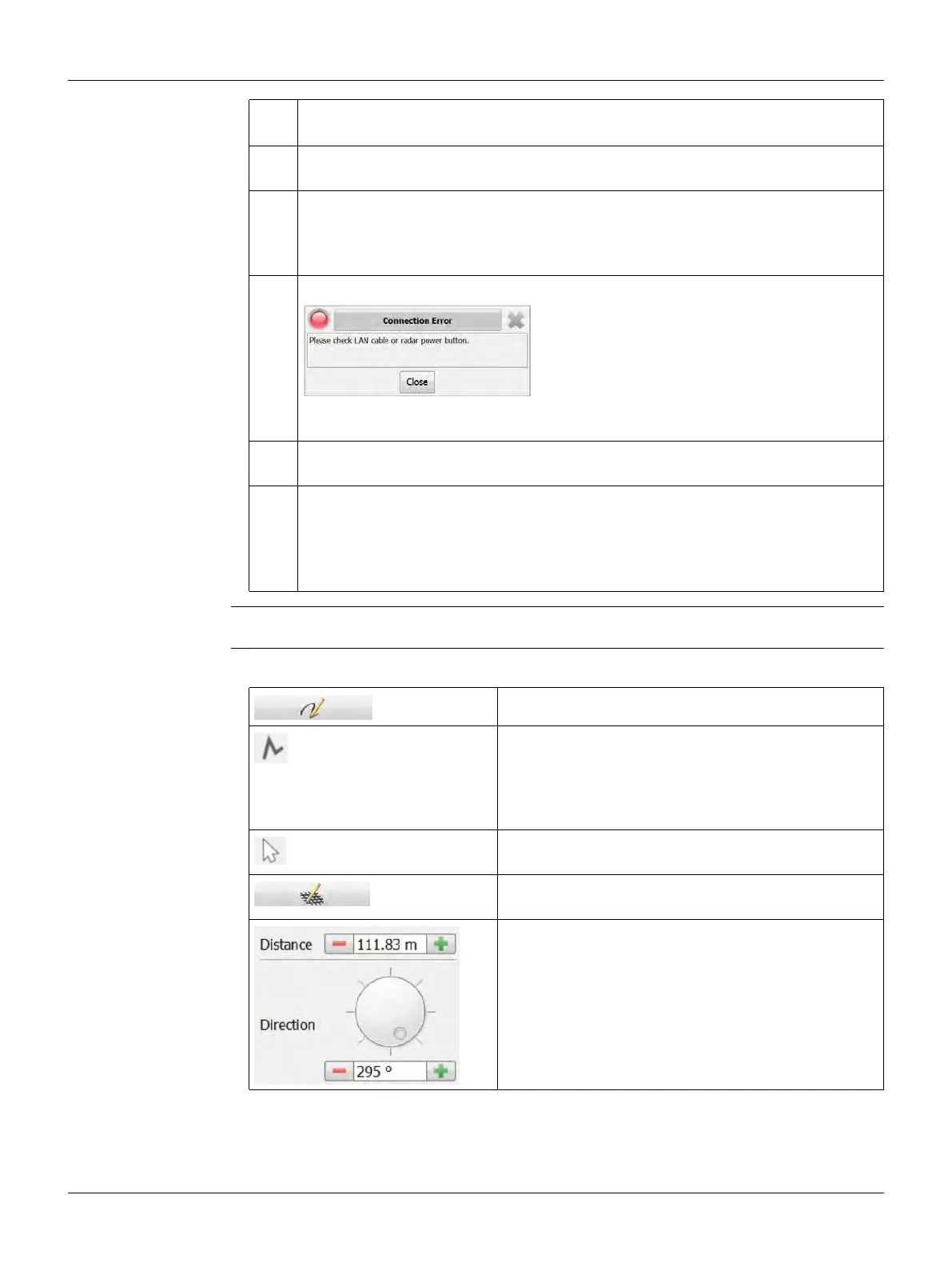
If the radar calibration fails, the following dialogue box is displayed.
Ensure that the Ethernet cable is connected properly to the laptop/tablet and
that the control unit is turned on.
If one of the radar channels does not work, an error screen indicates the faulty
channel.
4. As soon as the radar calibration is complete, the Acquisition screen is
displayed.
Use the acquisition commands to start and stop the acquisition of scan data.
For a detailed description of these and other available functions, refer to
"4.3.1 The Acquisition Screen".
Click this button to edit the reference line.
To draw a new grid reference line, click the right
button at the top of the Map section, then click on
the map to place two or more points.
The software connects the placed points to create
the reference line.
To pan the map, click the left button at the top of
the Map section, then click and drag the map.
Click this button to finish the drawing of the refer-
ence line.
To edit a single point of the reference line, select
the point in the map and change the parameters in
the Reference Line section.
You can change the distance from the previous
point and the angle relative to the previous
segment of the line.