90
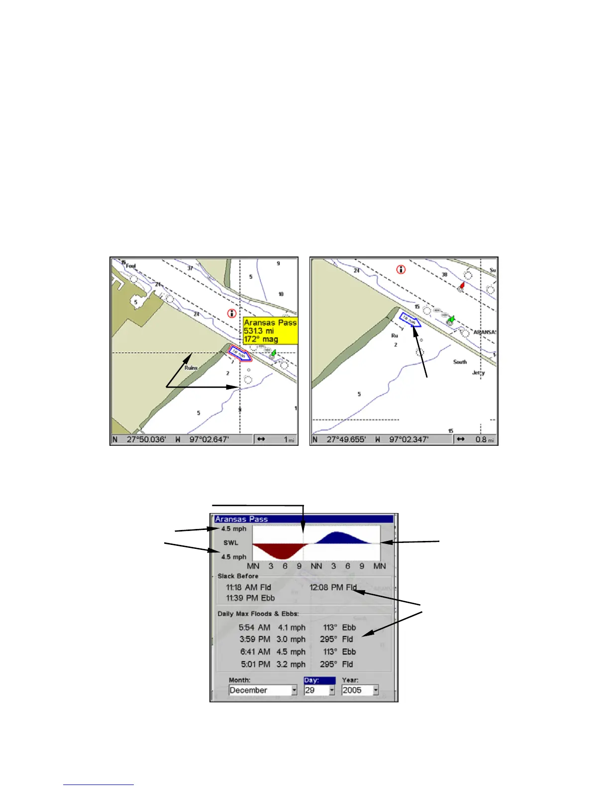
zoomed in to a 6-mile range. The icon stands for a Tidal Current Sta-
tion location. An example is displayed on the right.
When you zoom in to a sufficiently small zoom range (0.8 nautical
mile), the icon becomes an animated arrow showing tidal current veloc-
ity and direction for the selected tidal station at the present time. At
larger zoom ranges, you can select the boxed "C" icon and it becomes an
animated arrow with a pop-up name box (the name box disappears af-
ter a few seconds). Examples are displayed in the following figures.
To view Tidal Current information:
1. Use the arrow keys to move the cursor over a Tidal Current Station
icon. When it is selected, a pop-up name box appears.
2. Press
WPT to display the Tidal Current Information screen.
NauticPath chart showing Tidal Current Station icon selected by cur-
sor (left). Tidal Current animated icon at .8-nautical mile range.
Current Information screen.
Cursor
lines
Tidal Current
Station icon in
animated mode
Slack
Water
Line
Velocity
Scale
Tide Tables
Current Time Line
 Loading...