Do you have a question about the Magellan eXplorist 310 and is the answer not in the manual?
| Golf | - |
|---|---|
| Sport (fitness, running) | Yes |
| Marine (chartplotters, sounders) | No |
| Tracks quantity | 1 |
| Number of waypoints | 500 |
| GPS accuracy - position | 5 m |
| Map coverage | World |
| Display diagonal | 2.2 \ |
| Display resolution | 240 x 320 pixels |
| Storage media type | Flash |
| Internal storage capacity | 0.5 GB |
| Processor model | SiRFStar III |
| Processor frequency | 400 MHz |
| Form factor | Handheld |
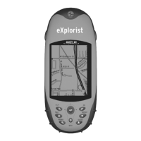
| Product color | Grey, Orange |
| International Protection (IP) code | IPX7 |
| USB 2.0 ports quantity | USB 2.0 ports have a data transmission speed of 480 Mbps, and are backwards compatible with USB 1.1 ports. You can connect all kinds of peripheral devices to them. |
| Battery type | AA |
| Power source type | Battery |
| Battery life (max) | 18 h |
| Battery technology | Alkaline |
| Number of batteries supported | 2 |
| Operating temperature (T-T) | -10 - 60 °C |
| Depth | 36 mm |
|---|---|
| Width | 56 mm |
| Height | 111 mm |
| Weight | 147 g |
Instructions for installing batteries, powering on/off, and conserving power.
Settings for backlight brightness, timers, and power saving.
Adjusting backlight, accessing dashboard, main, and options menus.
Configuring backlight timers and power off settings.
Using the BACK button and entering text/numeric data.
Overview, zoom, data fields, and compass on the Map screen.
Managing active tracks, navigation lines, and backtrack routes.
Using recorded tracks to navigate back to a starting point.
Navigating the map freely, creating waypoints, and accessing loaded maps.
Displaying, changing, and understanding different dashboard screen types.
Descriptions of Compass, Road, and Strip Compass screens.
Adjusting the number and type of data fields shown on dashboard screens.
Accessing, sorting, and searching saved waypoints.
Modifying existing waypoints and saving current locations.
Going to, viewing, and marking waypoints as favorites.
Creating waypoints by projection and saving current locations.
Transferring geocaches from websites using the 'Send to GPS' feature.
Installing geocaches using drag-and-drop or the Magellan Communicator.
Accessing, sorting, and searching the geocache list.
Modifying stored geocaches and creating routes to them.
Going to geocaches, viewing on map, and marking favorites.
Manually adding geocaches and viewing geocache summary statistics.
How to find POIs by category or name, and view their details.
Navigating the Tools Menu and accessing receiver settings.
Using track summary, geocache summary, and waypoint projection tools.
Using fishing/hunting times, sun/moon times, area calculation, and help.
Playing product demo, screen capture, and owner information settings.
Adjusting brightness, volume, and backlight timers.
Configuring suspend timers, power-off timers, and battery type.
Setting date format, time format, calendar format, and time zone.
Configuring map view, orientation, data fields, and lines.
Toggling map lines, detail levels, geocache criteria, POI visibility.
Setting units for distance, speed, elevation, and area.
Configuring track logging mode and various alarm settings.
Customizing joystick functions, night mode, and compass graphics.
Assigning background graphics, viewing satellite status, and GPS receiver control.
Configuring primary and secondary coordinate systems, types, accuracy, and datum.
North reference, altimeter source, memory, connectivity, and diagnostic tests.
Selecting language and viewing product serial number, SW version, EULA.
