EasyManua.ls Logo

RoboSense RS-LiDAR-16 User Manual

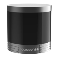
RoboSense RS-LiDAR-16
66 pages
To Next Page IconTo Next Page
Page #1 background imageLoading...
Page #1 background image
RS-LiDAR-16 User Manual
1

Table of Contents

Questions and Answers:

RoboSense RS-LiDAR-16 Specifications

General IconGeneral
TypeLiDAR
Number of Channels16
Accuracy± 2 cm
Weight0.83 kg
Laser Wavelength905 nm
Vertical Field of View30°
Angular Resolution (Vertical)
Protection Level/RatingIP67
Operating Voltage9-32 VDC
Power Consumption8 W (Typical)
Field of View360° horizontal, 30° vertical
Range150 m (80% reflectivity), 100 m (10% reflectivity)
Scan/Frame Rate10 Hz

Summary

Safety Notices and Precautions

General Safety Guidelines

Provides critical safety warnings including laser safety, handling instructions, and servicing guidelines.

Introduction to RS-LiDAR-16

Product Overview and Key Features

Introduces the RS-LiDAR-16, its unique features, and primary applications in autonomous systems.

Product Specifications

3.1 Product Format Details

Details the technical specifications of the RS-LiDAR-16, including sensor, laser, and output parameters.

3.2 Accuracy Performance

Presents the accuracy of the LiDAR sensor in relation to target distance, illustrated by a graph.

Connections and Wiring

4.1 Power and Electrical Configuration

Covers power requirements, voltage, consumption, and electrical wiring terminal details.

4.2 Wiring Terminal Pin Definitions

Details the wiring terminal and pin assignments for connecting the LiDAR sensor.

4.3 Interface Box Description

Describes the interface box functionality, ports, and indicator LEDs for the LiDAR system.

4.4 Interface Box Connection Diagram

Illustrates the connection diagram for the RS-LiDAR-16 interface box.

Communications Protocols

Overview of MSOP, DIFOP, and UCWP Protocols

Introduces UDP protocols, MSOP, DIFOP, and UCWP for data transmission and control.

5.1 MSOP Packet Structure

Details the structure of the MSOP packet, including header, data blocks, and tail.

MSOP Packet Header Details

Explains the 42-byte header, including identification, timestamp, and LiDAR model flag.

MSOP Data Field and Azimuth Calculation

Covers data field, azimuth value, and interpolation methods for point cloud data.

MSOP Channel Data and Distance Calculation

Details channel data format, reflectivity, and distance calculation based on firmware.

MSOP Packet Tail and Demonstration Data

Describes the 6-byte tail of MSOP packets and provides example data displays.

5.2 DIFOP Protocol Explained

Explains the DIFOP protocol for device information, including its data format.

5.3 UCWP Protocol Explained

Describes the UCWP protocol for user configuration and its packet structure.

UCWP Packet Structure and Parameter Settings

Provides an example of setting parameters using the UCWP protocol.

GPS Synchronization

GPS Synchronization Theory and Usage Protocols

Explains GPS synchronization using PPS and GPRMC, and usage protocols (TTL/RS232).

Key Features

7.1 Return Mode Principles

Details the different return modes (Strongest, Last, Dual) supported by the LiDAR.

7.2 Phase Lock Feature

Describes the phase-lock feature to minimize interference between multiple LiDAR sensors.

Point Cloud

8.1 Coordinate Mapping for Point Clouds

Explains the transformation of LiDAR data into Cartesian coordinates for point cloud generation.

8.2 Point Cloud Presentation

Describes how point clouds are presented in different environments and scenarios.

Laser Channels and Vertical Angles

Laser Channel and Vertical Angle Details

Details the 16 laser channels and their corresponding vertical angles.

Calibrated Reflectivity

Calibrated Reflectivity Explained

Details how reflectivity data is generated, its interpretation, and calibration methods.

Troubleshooting

Common Troubleshooting Issues and Solutions

Provides solutions for common problems like LED status, data dropouts, and GPS synchronization.

Appendix A: Point Time Calculation

Point Time Calculation for MSOP Packets

Explains the calculation of point time and time offset for MSOP packets.

Appendix B: Information Registers

B.1 Motor Speed and Direction (MOT_SPD)

Details the register for setting and reading motor speed and direction.

B.2 Ethernet Configuration Registers

Describes registers for LiDAR IP, PC IP, MAC Address, and port settings.

B.3 FOV Setting (FOV SET)

Explains how to set the horizontal angle range (FOV) for data output.

B.4 Motor Phase Offset (MOT_PHASE)

Details the register for adjusting motor phase offset with PPS.

B.5 Top Board Firmware (TOP_FRM)

Provides information on the top board firmware revision.

B.6 Bottom Board Firmware (BOT_FRM)

Provides information on the bottom board firmware revision.

B.7 Corrected Vertical Angle (COR_VERT_ANG)

Details the register for corrected vertical angle data for each channel.

B.8 Serial Number (SN) Register

Describes the format and retrieval of the device's serial number.

B.9 Software Version (SOFTWARE_VER)

Explains the software version register for compatibility.

B.10 UTC Time (UTC_TIME) Register

Details the register structure for capturing and setting UTC time.

B.11 Status Registers

Describes registers for sensor power supply current and voltage readings.

B.12 Fault Diagnosis Registers

Details registers for temperature, communication error rates, and GPS status.

B.13 GPRMC Packet ASCII Code

Explains how GPRMC messages from GPS modules are stored in ASCII format.

Appendix C: RSView Software

C.1 RSView Features and Capabilities

Lists key features of RSView for data acquisition, visualization, and export.

C.2 Installing RSView Software

Provides step-by-step instructions for installing the RSView application.

C.3 Network Setup for RSView

Guides on configuring network settings for proper RSView operation.

C.4 Visualizing Streaming Sensor Data

Step-by-step guide on how to visualize live sensor data streams in RSView.

C.5 Capturing Data to PCAP File

Instructions on how to record sensor data into a PCAP file using RSView.

C.6 Replaying Captured Data from PCAP File

Guide on how to replay and examine recorded sensor data from PCAP files.

C.7 Factory Firmware Parameter Setting

How to modify LiDAR firmware parameters like rotation speed and network settings.

C.8 RSView Data Port Configuration

Steps to configure data port settings in RSView for correct data reception.

C.9 Firmware Online Update Process

Instructions for performing online firmware updates for the LiDAR sensor.

C.10 Fault Diagnosis with RSView

How to use RSView's fault diagnosis tool to monitor LiDAR status.

Appendix D: RS-LiDAR ROS Package

D.1 ROS Package Prerequisites

Lists the necessary software and system requirements for the ROS package.

D.2 Installing the RS-LiDAR ROS Package

Step-by-step guide to install the RS-LiDAR ROS package and dependencies.

D.3 Configuring PC IP Address for ROS

Details on setting the PC's static IP address for ROS communication.

D.4 Viewing Real-Time Data with ROS

Instructions on how to view real-time point cloud data using ROS and Rviz.

D.5 Viewing Recorded PCAP Files with ROS

Guide to viewing previously recorded pcap data using the ROS package.

Appendix E: Dimensions

LiDAR Physical Dimensions

Provides detailed dimensional drawings and measurements of the RS-LiDAR-16 unit.

Appendix F: Installation Suggestions

Mechanical Mounting Recommendations

Offers advice on smooth mounting surfaces, locating pins, and material for installation.

Appendix G: Distinguish MSOP/DIFOP Ports

Identifying MSOP and DIFOP Packets via Wireshark

Explains how to use Wireshark filters to differentiate MSOP and DIFOP packets.

Appendix H: Sensor Cleaning

Sensor Cleaning Procedures and Materials

Details required materials and methods for cleaning the LiDAR sensor safely.

Related product manuals