When entering the street, instead of a street name, it is possible to select the
centre of the entered city by touching
Centre
. Then it is no longer necessary to
enter the house number or junction.
When entering the address, the function key
Map
is displayed on the input
screen » page 8. When you press the function key, the system opens a screen
with the map » page 52 where you can specify the address more precisely or
check it.
If the entered house number was not found, a menu opens to clarify the destina-
tion:
■
No house number
- Enter an address without a house number and display a menu
with destination details
■
Nearest house number:
- Enter the house number suggested by the unit
■
Enter junction
- Open a menu with junctions with the selected street
If the address was entered correctly, the following is displayed:
■
Start
- Route calculation starts with subsequent selection of route type and
route guidance or with guidance according to the preferred route type
■
Route options
- Display a menu for setting the route parameters » page 44
■
Store
- Store the destination in the destination memory » page 8
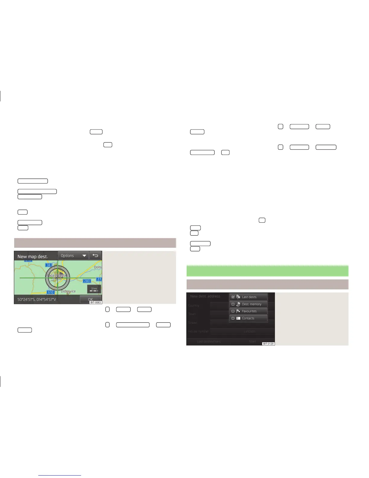
Map
Fig. 35
Destination entry in the map
›
In the main menu of navigation mode, press
→
Options
→
On map
or
›
In the main menu of navigation mode, press
→
New dest./stopover
→
Options
→
On map
or
›
In the main menu of navigation mode, press
→
Other POIs
→
Options
→
On map
.
Entry on the map is also used for entering the search area for POIs » page 53.
›
In the main menu of navigation mode, press
→
Other POIs
→
Search area
→
Select on map
→
Edit
.
After starting off, the crosshairs indicate the position of the pre-filled ad-
dress » Fig. 34 on page 51.
Set the desired destination to the centre of the crosshairs by dragging with your
finger on the map.
By touching the map, the contact point moves to the crosshairs, while the map
scale is reduced by one step.
The symbol
displays the current map scale.
The bottom of the screen displays the address or the longitude and latitude of
the selected item.
Confirm the destination by touching
OK
. Then the following items are displayed:
■
Store
- Store the destination in the destination memory » page 8
■
Edit
- Return to the main menu with the option to enter the destina-
tion » page 51
■
Route opts.
- Display a menu for setting the route parameters » page 44
■
Start
- Route calculation starts with subsequent selection of route type and
route guidance or with guidance according to the preferred route type
Entering from stored destinations
My destinations
Fig. 36
My destinations menu
52
Navigation
 Loading...