25Trail Tech Voyager
The satellite tab displays a graph of the sky and
the relative GPS satellite reception. The sky
graph shows the position of the satellites in the
sky.
User Interface » Navigation and Satellite Tabs
Satellite Tab:
Latitude / Longitude:
Satellite Tab
The reception bar graph shows the relative
signal strength of each satellite.
Press RIGHT from the satellite screen to view
your current latitude and longitude positions.
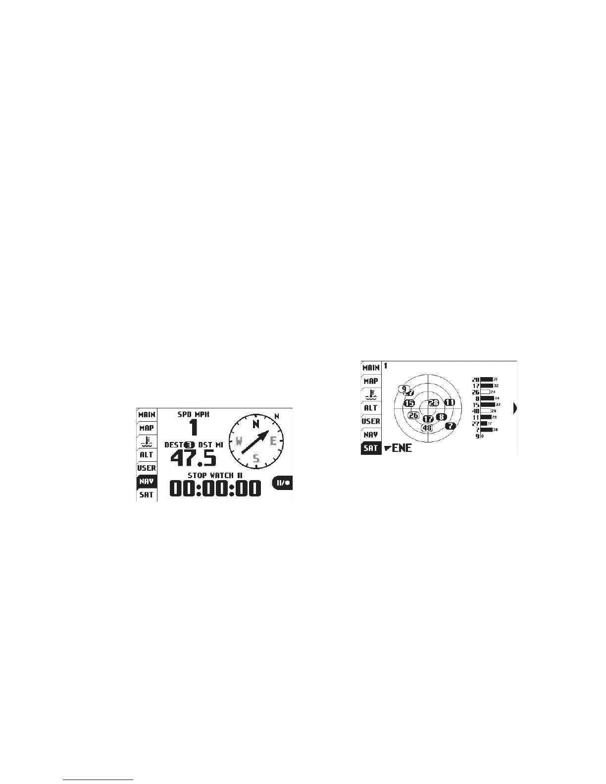
The navigation tab displays a compass, current
speed, trip distance or destination distance (the
distance to the currently selected waypoint) and
a stop watch.
If a destination waypoint has been selected,
then “destination distance” will be displayed and
the compass arrow will point towards the desired
waypoint (when it points straight up, you are
heading in the correct direction.) Press MENU
to select a
waypoint
destination
from the
quick menu.
Navigation Tab:
Navigation Tab
Set a destination waypoint at base camp before
leaving, and the navigation compass always
points back in case you get lost..
Navigation Example:
Destination Waypoints:
Start or stop the stop watch by pressing ENTER.
Press and hold ENTER to reset the stop watch.
Stop Watch: