EasyManuals Logo

Trail Tech Voyager User Manual

Trail Tech Voyager
48 pages
To Next Page IconTo Next Page
To Previous Page IconTo Previous Page
Page #41 background imageLoading...
Page #41 background image
41Trail Tech Voyager
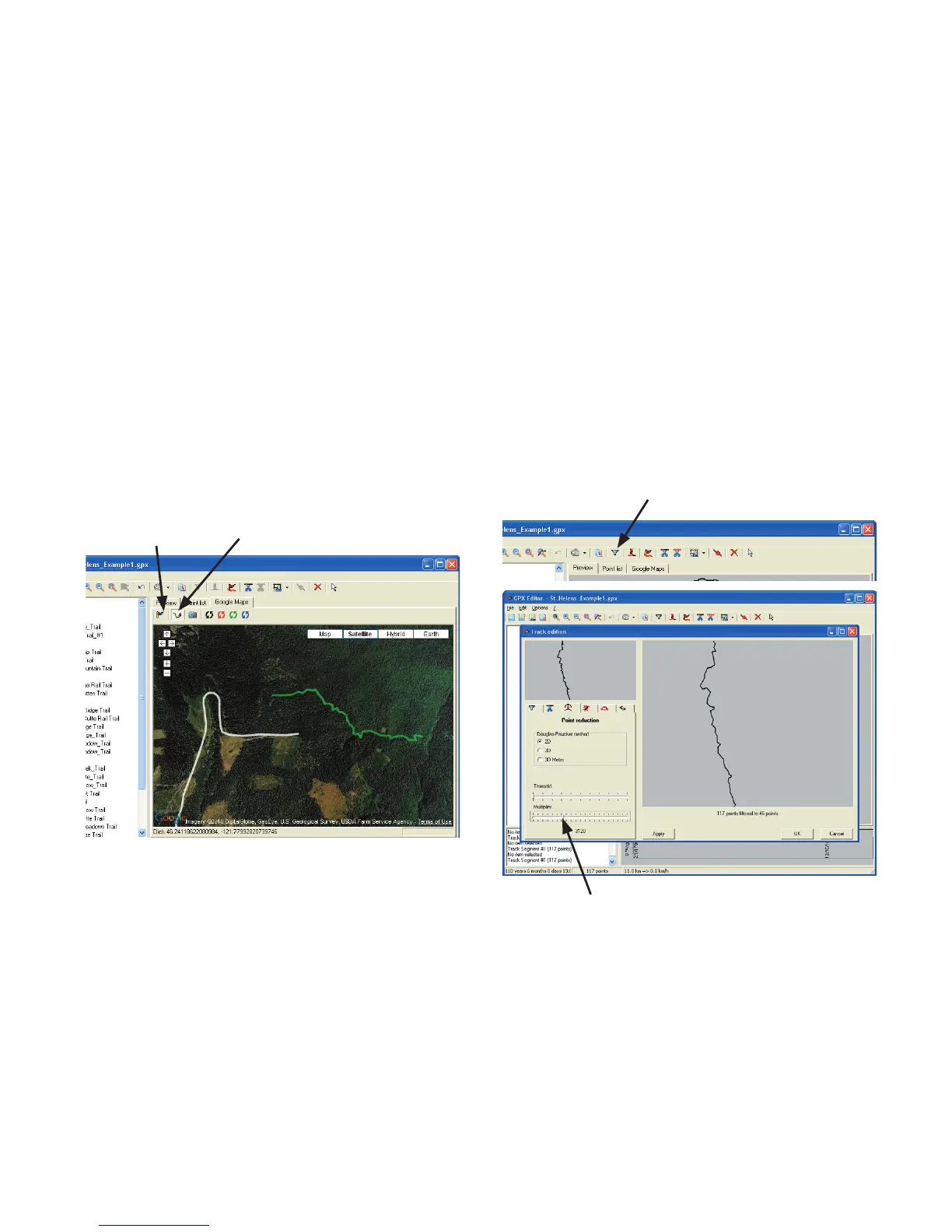
On the Google-Maps tab in Satellite mode, you
can overdraw your own trails and set waypoints
anywhere on the map. When drawing a route,
click once on the map for each data point (many
data points make up a track segment.)
Add
Waypoint
Draw a route by
clicking on the map
Draw New Track:
Tracks created by some sources will have far too
many data points. To reduce file size, remove
some of the data points (so it loads faster in
Voyager.) Select the track with the select tool,
then press the Filter button in the toolbar.
Reduce Number of Data Points:
Filter/Simplify
Simplify until you see detail being reduced.
GPX Editor

Questions and Answers:

Question and Answer IconNeed help?

Do you have a question about the Trail Tech Voyager and is the answer not in the manual?

Trail Tech Voyager Specifications

General IconGeneral
Display Size2.7 inches
Water ResistanceIP67
GPS ReceiverHigh-sensitivity
MountingHandlebar Mount
Data LoggingYes
Memory8 MB
SensorsGPS, Temperature
Power SourceLithium-ion battery
Routes10

Related product manuals