EasyManuals Logo

Trail Tech Voyager User Manual

Trail Tech Voyager
48 pages
To Next Page IconTo Next Page
To Previous Page IconTo Previous Page
Page #42 background imageLoading...
Page #42 background image
42 Trail Tech Voyager
Street Maps
Openstreetmaps.org
You can load street maps
into Voyager.
www.openstreetmaps.org
First, find the roads you want to
upload into Voyager. You should
only select the small area around
the planned ride, to reduce the file
sizes.
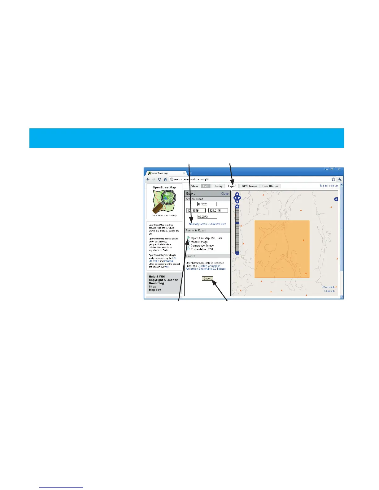
1. Go to Openstreetmaps.org.
2. Go to the Export tab.
3. Click on “Manually select a
different area.”
4. Click and drag a box on the
map that contains the roads you
want to upload to Voyager.
5. Click the Export button.
The file will export in .OSM format, which needs to be converted
to .GPX for Voyager. Use GPSBabel for the conversion.
Export Tab
Manually Select
OSM XML Data Export Button

Questions and Answers:

Question and Answer IconNeed help?

Do you have a question about the Trail Tech Voyager and is the answer not in the manual?

Trail Tech Voyager Specifications

General IconGeneral
Display Size2.7 inches
Water ResistanceIP67
GPS ReceiverHigh-sensitivity
MountingHandlebar Mount
Data LoggingYes
Memory8 MB
SensorsGPS, Temperature
Power SourceLithium-ion battery
Routes10

Related product manuals